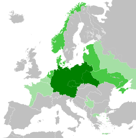
Fayl:Greater German Reich (1942).svg

Size of this PNG preview of this SVG file: 450 × 456 piksel. Boshqa oʻlchamlari: 237 × 240 piksel | 474 × 480 piksel | 758 × 768 piksel | 1 011 × 1 024 piksel | 2 021 × 2 048 piksel.
Asl fayl (SVG fayl, asl oʻlchamlari 450 × 456 piksel, fayl hajmi: 594 KB)


.svg)
.svg)
.svg)
.svg)
.svg)


.svg)
.svg)
.svg)


.png)
.png)


.svg)


.svg)

.svg)


.svg)
.svg)
.svg)
.svg)


.svg)
.png)


.svg)


.svg)
.svg)


.svg)


.svg)


.svg)
.svg)
.svg)
.svg)
.svg)
.svg)
.svg)
.svg)
_cropped.svg)
.svg)
.svg)
.svg)
.svg)
.svg)
.svg)
.svg)
.svg)
.svg)
.svg)
.svg)
.svg)
.svg)
.svg)
.svg)
.svg)
.svg)
.svg)
.svg)
.svg)
.svg)
.svg)
.svg)
.svg)
.svg)
.svg)
.svg)
.svg)
.svg)
.svg)
.svg)
.svg)
.svg)
.svg)
.svg)
.svg)
.svg)
.svg)
.svg)
.svg)
.svg)
.svg)
.svg)
.svg)
.svg)
Fayl tarixi
Faylning biror paytdagi holatini koʻrish uchun tegishli sana/vaqtga bosingiz.
.svg&dir=prev)
.svg&offset=20180422235102)
.svg&offset=&limit=20)
.svg&offset=&limit=50)
.svg&offset=&limit=100)
.svg&offset=&limit=250)
.svg&offset=&limit=500)
| Sana/Vaqt | Miniatura | Oʻlchamlari | Foydalanuvchi | Izoh | |
|---|---|---|---|---|---|
| joriy | 20:48, 20-Mart 2023 | | 450 × 456 (594 KB) | Qbox673 | Reverted to version as of 07:51, 23 August 2020 (UTC) Please establish consensus on the talk page before changing. |
| 19:16, 19-Mart 2023 |  | 450 × 456 (1,51 MB) | Daniilnihuya | Reverted to version as of 18:47, 22 August 2020 (UTC) | |
| 07:51, 23-Avgust 2020 |  | 450 × 456 (594 KB) | BOS2077 | Reverted to version as of 13:23, 28 July 2020 (UTC) | |
| 18:47, 22-Avgust 2020 |  | 450 × 456 (1,51 MB) | Terryfirut | Reverted to version as of 17:17, 5 July 2020 (UTC) | |
| 13:23, 28-Iyul 2020 |  | 450 × 456 (594 KB) | Staberinde | Reverted to version as of 01:04, 24 April 2018 (UTC) restore old version, puppet states are not the same thing as occupied territory | |
| 04:12, 7-Iyul 2020 |  | 450 × 456 (1,04 MB) | Croatianpotato | Reverted to version as of 22:35, 4 July 2020 (UTC) | |
| 17:17, 5-Iyul 2020 |  | 450 × 456 (1,51 MB) | Hell - lllio | Winter Offensive Occupied Territory | |
| 22:35, 4-Iyul 2020 |  | 450 × 456 (1,04 MB) | Hell - lllio | Vichy France (and its colonies) and Slovakia we're German Puppet States, so it should be Included in the Civilian Controlled Occupied Territories (Puppets) | |
| 01:04, 24-Aprel 2018 |  | 450 × 456 (594 KB) | TRAJAN 117 | +++ | |
| 23:51, 22-Aprel 2018 |  | 450 × 456 (594 KB) | TRAJAN 117 | +++ |
Fayllarga ishoratlar
Bu faylga quyidagi sahifa bogʻlangan:
Faylning global foydalanilishi
Ushbu fayl quyidagi vikilarda ishlatilyapti:
- ar.wikipedia.org loyihasida foydalanilishi
- av.wikipedia.org loyihasida foydalanilishi
- az.wikipedia.org loyihasida foydalanilishi
- bbc.wikipedia.org loyihasida foydalanilishi
- bg.wikipedia.org loyihasida foydalanilishi
- cs.wikipedia.org loyihasida foydalanilishi
- el.wikipedia.org loyihasida foydalanilishi
- en.wikipedia.org loyihasida foydalanilishi
- es.wikipedia.org loyihasida foydalanilishi
- fr.wikipedia.org loyihasida foydalanilishi
- gn.wikipedia.org loyihasida foydalanilishi
- he.wikipedia.org loyihasida foydalanilishi
- hr.wikipedia.org loyihasida foydalanilishi
- hu.wikipedia.org loyihasida foydalanilishi
- id.wikipedia.org loyihasida foydalanilishi
- Jerman Nazi
- Daftar imperium terbesar
- Anschluss
- Wikipedia:Artikel pilihan/Jadwal/Usulan/2020
- Wikipedia:Artikel pilihan/Jadwal/Usulan/2020/Periode 3
- Wikipedia:Artikel pilihan/Jadwal/Usulan/2020/Periode 8
- Wikipedia:Artikel pilihan/Daftar artikel pilihan 2020
- Wikipedia:Artikel Pilihan/32 2020
- Wikipedia:Arsip halaman utama/2020/08/03
- Wikipedia:Arsip halaman utama/2020/08/04
- Wikipedia:Arsip halaman utama/2020/08/05
- Wikipedia:Arsip halaman utama/2020/08/06
- Wikipedia:Arsip halaman utama/2020/08/07
- Wikipedia:Arsip halaman utama/2020/08/08
- Wikipedia:Arsip halaman utama/2020/08/09
- Wikipedia:Artikel pilihan/Daftar artikel pilihan 2023
- Wikipedia:Artikel pilihan/Jadwal/Usulan/2023
Ushbu faylni koʻproq global foydalanishdan koʻring.
.svg)
.svg)