Fayl:Thuringia location map.svg

Size of this PNG preview of this SVG file: 764 × 599 piksel. Boshqa oʻlchamlari: 306 × 240 piksel | 612 × 480 piksel | 979 × 768 piksel | 1 280 × 1 004 piksel | 2 560 × 2 009 piksel | 966 × 758 piksel.
Asl fayl (SVG fayl, asl oʻlchamlari 966 × 758 piksel, fayl hajmi: 161 KB)
Qisqa izoh
| Taʼrif |
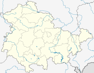
Deutsch: Positionskarte Thüringen, Deutschland. Geographische Begrenzung der Karte:
English: Location map Thuringia, Germany. Geographic limits of the map:
|
|||
| Sanasi | ||||
| Manba |
own work, templates were:
|
|||
| Muallif | TUBS | |||
| Other versions |
Derivative works of this file: Location map of the scope of the Rhein-Main-Verkehrsverbund.svg
|
|||
| SVG genesis | This map was created with Adobe Illustrator, and with Inkscape.
|


Litsenziyalash
I, the copyright holder of this work, hereby publish it under the following licenses:

|
Ushbu hujjatdan nusxa ko‘chirish, tarqatish va/yoki o‘zgartirish uchun GNU Erkin guvohnoma litsenziyasi (GNU Free Documentation License), 1.2 va har qanday keyingi versiyalar shartlariga muvofiq ruxsat berilgan yoki Ochiq kodli dasturlar jamiyati (Free Software Foundation) tomonidan chop etilgan; oʻzgarmas boʻlimlarsiz, oldingi muqova matnlari va orqa muqova matnlarisiz. Litsenziya nusxasi GNU Erkin guvohnoma litsenziyasi (GNU Free Documentation License) boʻlimiga kiritilgan. |
This file is licensed under the Creative Commons Attribution-Share Alike 3.0 Unported, 2.5 Generic, 2.0 Generic and 1.0 Generic license.
- Siz erkinsiz:
- ulashishga – ishlanmani nusxalash, tarqatish va uzatish
- remiks qilishga – ishni moslashtirishga
- Quyidagi shartlar asosida:
- atribut – Siz tegishli litsenziyaga havolani taqdim etishingiz va oʻzgartirishlar kiritilganligini koʻrsatishingiz kerak. Siz buni har qanday oqilona yoʻl bilan qilishingiz mumkin, lekin litsenziar Sizni yoki Sizning foydalanishingizni ma'qullashini taklif qiladigan tarzda emas.
- bir xil ulashish – Agar Siz materialni remiks qilsangiz, oʻzgartirsangiz yoki unga asoslansangiz, oʻz hissalaringizni asl nusxadagi kabi bir xil yoki mos litsenziya ostida tarqatishingiz kerak.
Siz oʻzingiz xohlagan litsenziyani tanlashingiz mumkin.
Fayl tarixi
Faylning biror paytdagi holatini koʻrish uchun tegishli sana/vaqtga bosingiz.
| Sana/Vaqt | Miniatura | Oʻlchamlari | Foydalanuvchi | Izoh | |
|---|---|---|---|---|---|
| joriy | 19:35, 31-Dekabr 2023 | | 966 × 758 (161 KB) | NordNordWest | upd |
| 11:10, 31-Dekabr 2022 |  | 966 × 758 (161 KB) | NordNordWest | upd | |
| 17:47, 30-Iyun 2021 |  | 966 × 758 (161 KB) | NordNordWest | upd | |
| 12:08, 30-Dekabr 2018 |  | 966 × 758 (162 KB) | NordNordWest | upd 2019 | |
| 18:11, 11-Oktyabr 2009 |  | 966 × 758 (642 KB) | Alexrk2 | Landesgrenze und vereinzelt Flussläufe korrigiert | |
| 00:44, 31-Yanvar 2009 |  | 966 × 758 (670 KB) | TUBS | Improved rivers outside thuringia | |
| 00:09, 29-Yanvar 2009 |  | 966 × 758 (732 KB) | TUBS | == Summary == {{Information |Description= {{de|Positionskarte Thüringen, Deutschland. Geographische Begrenzung der Karte:}} {{en|Location map Thuringia, Germany. Geographic limits of the map:}} * N: 50.xx° N * S: 4 | |
| 00:00, 29-Yanvar 2009 |  | 966 × 758 (732 KB) | TUBS | == Summary == {{Information |Description= {{de|Positionskarte Thüringen, Deutschland. Geographische Begrenzung der Karte:}} {{en|Location map Thuringia, Germany. Geographic limits of the map:}} * N: 50.xx° N * S: 4 | |
| 23:43, 28-Yanvar 2009 |  | 966 × 758 (734 KB) | TUBS | == Summary == {{Information |Description= {{de|Positionskarte Thüringen, Deutschland. Geographische Begrenzung der Karte:}} {{en|Location map Thuringia, Germany. Geographic limits of the map:}} * N: 50.xx° N * S: 4 |
Fayllarga ishoratlar
Bu faylga quyidagi 4 sahifalar bogʻlangan:
Faylning global foydalanilishi
Ushbu fayl quyidagi vikilarda ishlatilyapti:
- ar.wikipedia.org loyihasida foydalanilishi
- azb.wikipedia.org loyihasida foydalanilishi
- ba.wikipedia.org loyihasida foydalanilishi
- Абтсбессинген
- Айзенах
- Айзенберг (Тюрингия)
- Айнеборн
- Айнхаузен (Тюрингия)
- Айсфельд
- Айхенберг (Йена)
- Айхенберг (Хильдбургхаузен)
- Айхструт
- Аллендорф (Тюрингия)
- Альберсдорф (Тюрингия)
- Алькерслебен
- Альперштедт
- Альтенберга
- Альтенбойтен
- Альтенбург
- Альтенготтерн
- Альтенфельд
- Альтерсбах
- Альткирхен
- Альштедт
- Ангельрода
- Анденхаузен
- Андислебен
- Анроде
- Апольда
- Апфельштедт
- Аренсхаузен
- Арнсгеройт
- Арнштадт
- Артерн (Унструт)
- Асбах-Зикенберг
- Аспах (Тюрингия)
- Аулебен
- Аума
- Ауэнгрунд
- Ауэрштедт
- Ашенхаузен
- Бёлен (Тюрингия)
- Бёслебен-Вюллерслебен
- Бад-Берка
- Бад-Бланкенбург
- Бад-Зальцунген
- Бад-Зульца
Ushbu faylni koʻproq global foydalanishdan koʻring.