Fayl:Nördlinger Ries Relief Map, SRTM-1.jpg
Bu prevyuning hajmi: 800 × 600 piksel. Boshqa oʻlchamlari: 320 × 240 piksel | 640 × 480 piksel | 1 024 × 768 piksel | 1 280 × 960 piksel | 1 600 × 1 200 piksel.
Asl fayl (1 600 × 1 200 piksel, fayl hajmi: 1,39 MB, MIME tipi: image/jpeg)
Qisqa izoh
| Taʼrif | |
| Sanasi | |
| Manba |
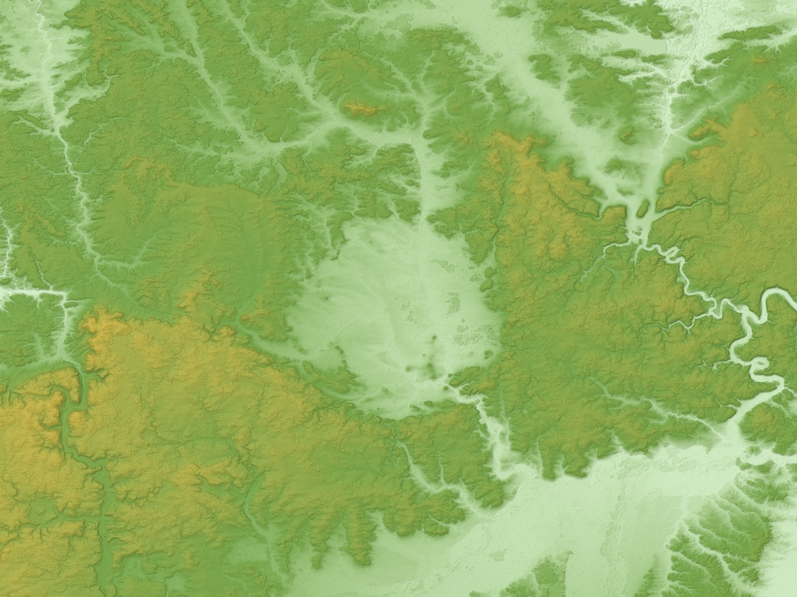
Topographic data: NASA's SRTM-1 30m Mesh (ver.3 2014) |
| Muallif | Batholith |
| Object location | | View this and other nearby images on: OpenStreetMap |
|---|
Litsenziyalash
| I, the copyright holder of this work, release this work into the public domain. This applies worldwide. In some countries this may not be legally possible; if so: I grant anyone the right to use this work for any purpose, without any conditions, unless such conditions are required by law. |
This image uses high-resolution digital topography data from NASA's Shuttle Radar Topography Mission (SRTM) at JPL-Caltech [1]. It is in the public domain in the United States.
|
 | |
Fayl tarixi
Faylning biror paytdagi holatini koʻrish uchun tegishli sana/vaqtga bosingiz.
| Sana/Vaqt | Miniatura | Oʻlchamlari | Foydalanuvchi | Izoh | |
|---|---|---|---|---|---|
| joriy | 13:01, 9-Mart 2016 | | 1 600 × 1 200 (1,39 MB) | Batholith | {{Information |Description= {{en|Relief map of Nördlinger Ries, Germany. Data from "SRTM-1 (30m Mesh) Ver.3 2014".}} |Source=NASA, [http://www2.jpl.nasa.... |
Fayllarga ishoratlar
Bu faylga quyidagi sahifa bogʻlangan:
Faylning global foydalanilishi
Ushbu fayl quyidagi vikilarda ishlatilyapti:
- de.wikipedia.org loyihasida foydalanilishi
- en.wikipedia.org loyihasida foydalanilishi
- it.wikipedia.org loyihasida foydalanilishi
- ja.wikipedia.org loyihasida foydalanilishi
- nl.wikipedia.org loyihasida foydalanilishi
- pl.wikipedia.org loyihasida foydalanilishi
- simple.wikipedia.org loyihasida foydalanilishi
- tr.wikipedia.org loyihasida foydalanilishi