Fayl:Aerial photo of Okama, the crater lake of Mt. Zaō in 1976.jpg

Bu prevyuning hajmi: 599 × 600 piksel. Boshqa oʻlchamlari: 240 × 240 piksel | 479 × 480 piksel | 767 × 768 piksel | 1 023 × 1 024 piksel | 2 045 × 2 048 piksel | 3 423 × 3 428 piksel.
Asl fayl (3 423 × 3 428 piksel, fayl hajmi: 15,62 MB, MIME tipi: image/jpeg)
Qisqa izoh
| Taʼrif |
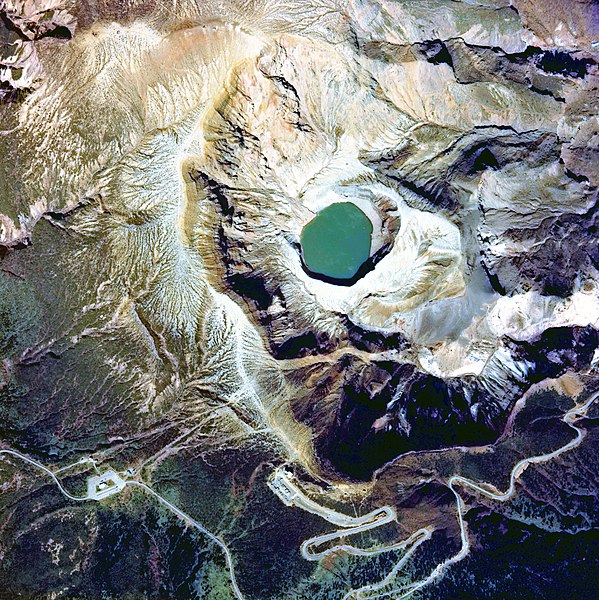
English: Aerial photo of Okama, the crater lake of Mt. Zaō volcano, Japan, in 1976
日本語: 1976年度(昭和51年度)に撮影された「御釜」周辺の国土画像情報(カラー空中写真)
|
| Sanasi | |
| Manba |
「国土画像情報(カラー空中写真) 国土交通省」 http://w3land.mlit.go.jp/cgi-bin/WebGIS2/WC_AirPhoto.cgi?IT=p&DT=n&PFN=CTO-76-20&PCN=C17&IDX=14 |
| Muallif | retouched by neuropower |
| Camera location | | View this and other nearby images on: OpenStreetMap |
|---|
Litsenziyalash

|
The copyright holder of this file, the Ministry of Land, Infrastructure, Transport and Tourism of Japan, allows anyone to use it for any purpose, provided that the copyright holder is properly attributed. Redistribution, derivative work, commercial use, and all other use is permitted. |
Attributsiya:
Copyright © National Land Image Information (Color Aerial Photographs), Ministry of Land, Infrastructure, Transport and Tourism
|
 |
This image is copyrighted by the Ministry of Land, Infrastructure, Transport and Tourism of Japan. For terms of use, see the stipulation to use of National Land Information (in Japanese) and message from MLIT (in Japanese and English). When you display this image on an article, include the following phrase in the description: "Made based on National Land Image Information (Color Aerial Photographs), Ministry of Land, Infrastructure, Transport and Tourism".
|
| Annotations | This image is annotated: View the annotations at Commons |
Fayl tarixi
Faylning biror paytdagi holatini koʻrish uchun tegishli sana/vaqtga bosingiz.
| Sana/Vaqt | Miniatura | Oʻlchamlari | Foydalanuvchi | Izoh | |
|---|---|---|---|---|---|
| joriy | 07:59, 18-Oktyabr 2017 | | 3 423 × 3 428 (15,62 MB) | Togabi | Color adjustment. |
| 03:54, 4-Iyun 2010 |  | 3 423 × 3 428 (3,37 MB) | Neuropower | {{Information |Description={{en|1=Aerial photo of Okama, the crater lake of Mt. Zaō in fiscal 1976}} {{ja|1=1976年度(昭和51年度)に撮影された「御釜」周辺の国土画像情報(カラー空中写真)}} |Source=「国土画像情報 |
Fayllarga ishoratlar
Bu faylga quyidagi sahifa bogʻlangan:
Faylning global foydalanilishi
Ushbu fayl quyidagi vikilarda ishlatilyapti:
- de.wikipedia.org loyihasida foydalanilishi
- en.wikipedia.org loyihasida foydalanilishi
- et.wikipedia.org loyihasida foydalanilishi
- eu.wikipedia.org loyihasida foydalanilishi
- ja.wikipedia.org loyihasida foydalanilishi
- ne.wikipedia.org loyihasida foydalanilishi
- sr.wikipedia.org loyihasida foydalanilishi
- www.wikidata.org loyihasida foydalanilishi