Fayl:Austria Styria adm location map.svg

Asl fayl (SVG fayl, asl oʻlchamlari 1 199 × 852 piksel, fayl hajmi: 637 KB)
Qisqa izoh
| Taʼrif |
Deutsch: Positionskarte der Steiermark, Österreich
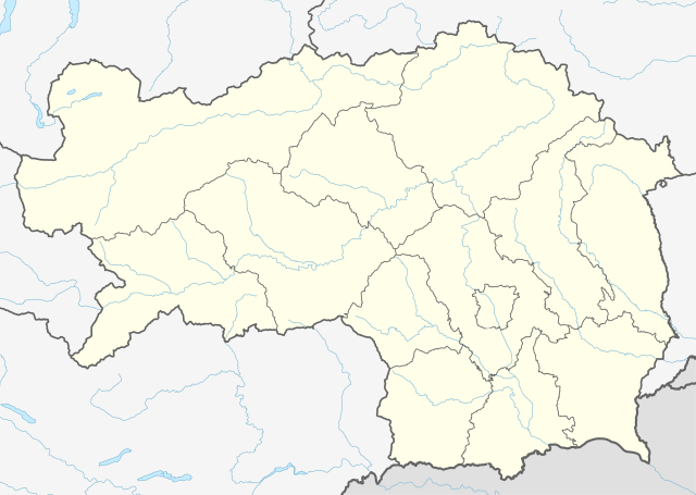
English: Location map of Styria, Austria
|
||||||||||||
| Sanasi | |||||||||||||
| Manba |
Own work using:
|
||||||||||||
| Muallif | NordNordWest | ||||||||||||
| Other versions |
|
||||||||||||
| SVG genesis | This locator map was created with Adobe Illustrator.
|
||||||||||||
_adm_location_map.svg)

Litsenziyalash
Usage of this file with:

explanatory notes: Legally binding is only the full legalcode. For a free usage I recommend to respect the following licence conditions:
1. Provide my name as given above: NordNordWest,
2. a copy of, or the URI for, the applicable license: https://creativecommons.org/licenses/by-sa/3.0/de/legalcode,
3. the title of the work,
4. in the case of an adaptation, a credit identifying the use of the work in the adaptation.
This license and the rights granted hereunder will terminate automatically upon any breach by you of the terms of this license. Any of the above conditions can be waived if you get permission from the copyright holder. If you have questions or wish differing conditions, please contact me through nnwest or my discussion page ![]() t-online.de
t-online.de
- Siz erkinsiz:
- ulashishga – ishlanmani nusxalash, tarqatish va uzatish
- remiks qilishga – ishni moslashtirishga
- Quyidagi shartlar asosida:
- atribut – Siz tegishli litsenziyaga havolani taqdim etishingiz va oʻzgartirishlar kiritilganligini koʻrsatishingiz kerak. Siz buni har qanday oqilona yoʻl bilan qilishingiz mumkin, lekin litsenziar Sizni yoki Sizning foydalanishingizni ma'qullashini taklif qiladigan tarzda emas.
- bir xil ulashish – Agar Siz materialni remiks qilsangiz, oʻzgartirsangiz yoki unga asoslansangiz, oʻz hissalaringizni asl nusxadagi kabi bir xil yoki mos litsenziya ostida tarqatishingiz kerak.

Fayl tarixi
Faylning biror paytdagi holatini koʻrish uchun tegishli sana/vaqtga bosingiz.
| Sana/Vaqt | Miniatura | Oʻlchamlari | Foydalanuvchi | Izoh | |
|---|---|---|---|---|---|
| joriy | 15:46, 30-Dekabr 2019 | | 1 199 × 852 (637 KB) | NordNordWest | upd |
| 12:20, 1-Yanvar 2015 |  | 1 199 × 852 (626 KB) | NordNordWest | == {{int:filedesc}} == {{Information |Description= {{de|1=Positionskarte der Steiermark, Österreich}} {{en|1=Location map of Styria, Austria}} {{Location map series N |stretching=– |top=47.8849333 |bottom=46.57305 |left=13.5085305 |right=16.2235138... |
Fayllarga ishoratlar
Bu faylga quyidagi 2 sahifalar bogʻlangan:
Faylning global foydalanilishi
Ushbu fayl quyidagi vikilarda ishlatilyapti:
- de.wikipedia.org loyihasida foydalanilishi
- Heilbrunn (Gemeinde Anger)
- Flughafen Graz
- Frauenmauerhöhle
- Katerloch
- Schwarzmooskogel-Höhlensystem
- Gruabn
- Grasslhöhle
- Hüttstatthöhle
- Franz-Fekete-Stadion
- DÖF-Sonnenleiter-Höhlensystem
- Grubstein-Westwandhöhle
- Merkur Arena (Graz)
- Tierwelt Herberstein
- Südwandhöhle
- Benutzer:Tigerente/Baustelle
- Shopping City Seiersberg
- Eisstadion Graz-Liebenau
- Ski amadé
- Rettenwandhöhle
- Kraushöhle
- Drachenhöhle bei Mixnitz
- Odelsteinhöhle
- Badlhöhle
- Lurgrotte
- Repolusthöhle
- Dampfkraftwerk Voitsberg
- Schönberg-Höhlensystem
- Sportzentrum Zeltweg
- Panoramastadion (Bad Aussee)
- Wassermannsloch
- KLH-Arena
- Tauernwindpark
- Leoben City Shopping
- Vorlage:Positionskarte Österreich Steiermark
- Räuberhöhle (Spital am Semmering)
- Profertil Arena Hartberg
- Skigebiet Dachsteingletscher
- Krankenhaus der Elisabethinen Graz
- Einkaufszentrum Murpark
- Böhler Bleche
- Sportstadion Marktgemeinde Gratkorn
- Dekanat Graz-Mitte
- Dekanat Graz-Nord
- Fernheizkraftwerk Neudorf-Werndorf
- Flugplatz Fürstenfeld
- Flugplatz Niederöblarn
- Rechenbrücke
- Österreichische Fußballmeisterschaft 2012/13
- Gas- und Dampfkraftwerk Mellach
Ushbu faylni koʻproq global foydalanishdan koʻring.