Fayl:Bouvet Island relief location map.svg

Size of this PNG preview of this SVG file: 791 × 600 piksel. Boshqa oʻlchamlari: 317 × 240 piksel | 633 × 480 piksel | 1 013 × 768 piksel | 1 280 × 971 piksel | 2 560 × 1 942 piksel | 1 693 × 1 284 piksel.
Asl fayl (SVG fayl, asl oʻlchamlari 1 693 × 1 284 piksel, fayl hajmi: 699 KB)
Qisqa izoh
| Camera location | | View this and other nearby images on: OpenStreetMap |
|---|
| Taʼrif |
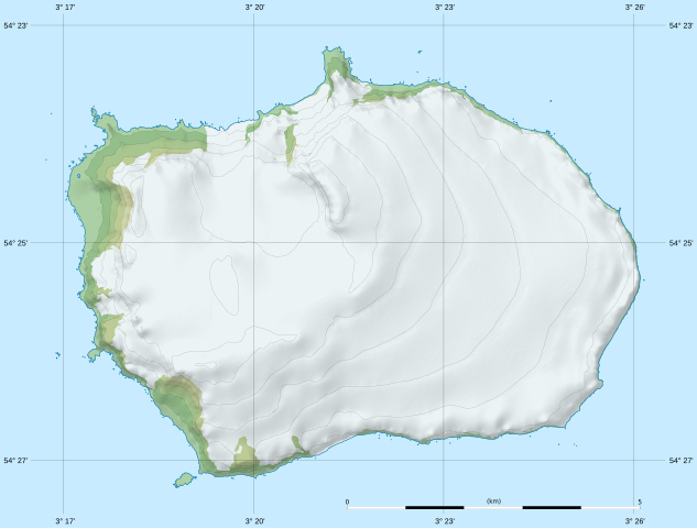
Deutsch: Relief Positionskarte von Bouvetinsel
English: Blank relief location map of Bouvet Island
Français : Carte physique vierge de l’île Bouvet, destinée à la géolocalisation. Scale: 1:80,000 (precision: 20 m for the topography and ground features)
Geographic limits of the map:
|
|||||||||
| Sanasi | ||||||||||
| Manba | data: Norwegian Polar Institute (modified for the shaded relief) (under CC-BY 4.0) | |||||||||
| Muallif | Eric Gaba (Sting - fr:Sting) | |||||||||
| Ruxsat (Bu faylning takror foydalanilishi) |
|
|||||||||
| Other versions |
|
|||||||||

Litsenziyalash
I, the copyright holder of this work, hereby publish it under the following license:
This file is licensed under the Creative Commons Attribution-Share Alike 4.0 International license.
- Siz erkinsiz:
- ulashishga – ishlanmani nusxalash, tarqatish va uzatish
- remiks qilishga – ishni moslashtirishga
- Quyidagi shartlar asosida:
- atribut – Siz tegishli litsenziyaga havolani taqdim etishingiz va oʻzgartirishlar kiritilganligini koʻrsatishingiz kerak. Siz buni har qanday oqilona yoʻl bilan qilishingiz mumkin, lekin litsenziar Sizni yoki Sizning foydalanishingizni ma'qullashini taklif qiladigan tarzda emas.
- bir xil ulashish – Agar Siz materialni remiks qilsangiz, oʻzgartirsangiz yoki unga asoslansangiz, oʻz hissalaringizni asl nusxadagi kabi bir xil yoki mos litsenziya ostida tarqatishingiz kerak.
Fayl tarixi
Faylning biror paytdagi holatini koʻrish uchun tegishli sana/vaqtga bosingiz.
| Sana/Vaqt | Miniatura | Oʻlchamlari | Foydalanuvchi | Izoh | |
|---|---|---|---|---|---|
| joriy | 21:45, 17-Fevral 2020 | | 1 693 × 1 284 (699 KB) | Sting | == {{int:filedesc}} == {{Location|54|25|00|S|003|21|00|E|scale:100000}} {{Information |Description= {{de|Relief Positionskarte von Bouvetinsel}} {{en|Blank relief location map of Bouvet Island}} {{fr|Carte physique vierge de l’île Bouvet, destinée à la géolocalisation.}}<br/> Scale: 1:80,000 (precision: 20 m for the topography and ground features)<br/> Equirectangular projection, WGS84 datum<br/> *Standard meridian: 003.35835° E<br... |
Fayllarga ishoratlar
Bu faylga quyidagi 4 sahifalar bogʻlangan:
Faylning global foydalanilishi
Ushbu fayl quyidagi vikilarda ishlatilyapti:
- cs.wikipedia.org loyihasida foydalanilishi
- de.wikipedia.org loyihasida foydalanilishi
- Kap Circoncision
- Benutzer:Carport/Bouvetøya
- Vorlage:Positionskarte Bouvetinsel
- Posadowsky-Gletscher (Bouvetinsel)
- Kap Fie
- Christensen-Gletscher (Bouvetinsel)
- Horntvedt-Gletscher
- Morrell-Riff
- Røverhullet
- Sachsebåane
- Morgenstierne-Küste
- Victoria-Terrasse-Küste
- Mowinckel-Küste
- Vogt-Küste
- Esmarch-Küste
- Engelbrecht-Gletscher
- Randibreen
- Slakhallet
- Westwindstranda
- Selstranda
- Sjøelefantstranda
- Svartstranda
- Smalstranda
- Aagaardbreen
- Kraterisen
- Selbadet
- en.wikipedia.org loyihasida foydalanilishi
- eo.wikipedia.org loyihasida foydalanilishi
- fr.wikipedia.org loyihasida foydalanilishi
- mn.wikipedia.org loyihasida foydalanilishi
- no.wikipedia.org loyihasida foydalanilishi
- si.wikipedia.org loyihasida foydalanilishi