Fayl:California Mountain Ranges.gif
Bu prevyuning hajmi: 535 × 600 piksel. Boshqa oʻlchamlari: 214 × 240 piksel | 428 × 480 piksel | 685 × 768 piksel | 1 070 × 1 200 piksel.
Asl fayl (1 070 × 1 200 piksel, fayl hajmi: 234 KB, MIME tipi: image/gif, 0,1 soniya)
Qisqa izoh
| Taʼrif |
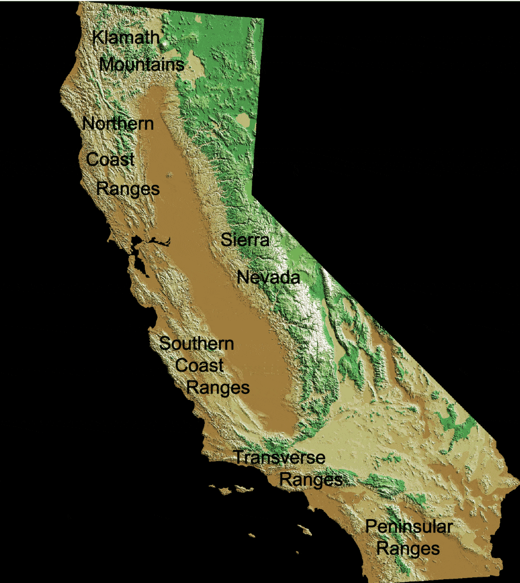
English: Mountain ranges of California:
Deutsch: Kalifornische Küstenketten |
| Sanasi | (UTC) |
| Manba |
This file was derived from: California Mountain Ranges.png:  |
| Muallif |
|
Litsenziyalash
Original map:
This image is in the public domain in the United States because it only contains materials that originally came from the United States Geological Survey, an agency of the United States Department of the Interior. For more information, see the official USGS copyright policy.
|
Captions:
| This work has been released into the public domain by its author, Jo Weber. This applies worldwide. In some countries this may not be legally possible; if so: |
Conversion to gif:
| This file is made available under the Creative Commons CC0 1.0 Universal Public Domain Dedication. | |
| The person who associated a work with this deed has dedicated the work to the public domain by waiving all of their rights to the work worldwide under copyright law, including all related and neighboring rights, to the extent allowed by law. You can copy, modify, distribute and perform the work, even for commercial purposes, all without asking permission.
|
Original upload log
This image is a derivative work of the following images:
- File:California Mountain Ranges.png licensed with PD-USGov-USGS, PD-user
- 2009-05-03T21:12:16Z Jo Weber 1364x1530 (1995923 Bytes) {{Information |Description= {{en|California Coast Ranges}} {{de|Kalifornische Küstenketten}} |Source=[[:File:Digital-elevation-map-california.gif]] |Date=2009-05-03 |Author=USGS / [[User:|Jo]] |Permission=see below |other_ve
Uploaded with derivativeFX
Fayl tarixi
Faylning biror paytdagi holatini koʻrish uchun tegishli sana/vaqtga bosingiz.
| Sana/Vaqt | Miniatura | Oʻlchamlari | Foydalanuvchi | Izoh | |
|---|---|---|---|---|---|
| joriy | 04:34, 28-Iyul 2022 | | 1 070 × 1 200 (234 KB) | Hike395 | == {{int:filedesc}} == {{Information |Description={{en|Mountain ranges of California: # {{w|California Coast Ranges}} # {{w|Sierra Nevada (U.S.)|Sierra Nevada}} # {{w|Transverse Ranges}} # {{w|Peninsular Ranges}} # {{w|Klamath Mountains}}}} {{de|Kalifornische Küstenketten}} |Source={{Derived from|California Mountain Ranges.png|display=50}} |Date=2022-07-28 04:30 (UTC) |Author=* File:California Mountain Ranges.png: Original map: USGS<br> * Edits:... |
Fayllarga ishoratlar
Bu faylga quyidagi sahifa bogʻlangan:
Faylning global foydalanilishi
Ushbu fayl quyidagi vikilarda ishlatilyapti:
- en.wikipedia.org loyihasida foydalanilishi
- he.wikipedia.org loyihasida foydalanilishi