Fayl:California Mountain Ranges.png
Bu prevyuning hajmi: 534 × 599 piksel. Boshqa oʻlchamlari: 214 × 240 piksel | 428 × 480 piksel | 685 × 768 piksel | 913 × 1 024 piksel | 1 364 × 1 530 piksel.
Asl fayl (1 364 × 1 530 piksel, fayl hajmi: 1,9 MB, MIME tipi: image/png)

|
This map image could be re-created using vector graphics as an SVG file. This has several advantages; see Commons:Media for cleanup for more information. If an SVG form of this image is available, please upload it and afterwards replace this template with
{{vector version available|new image name}}.
It is recommended to name the SVG file “California Mountain Ranges.svg”—then the template Vector version available (or Vva) does not need the new image name parameter. |
| Taʼrif |
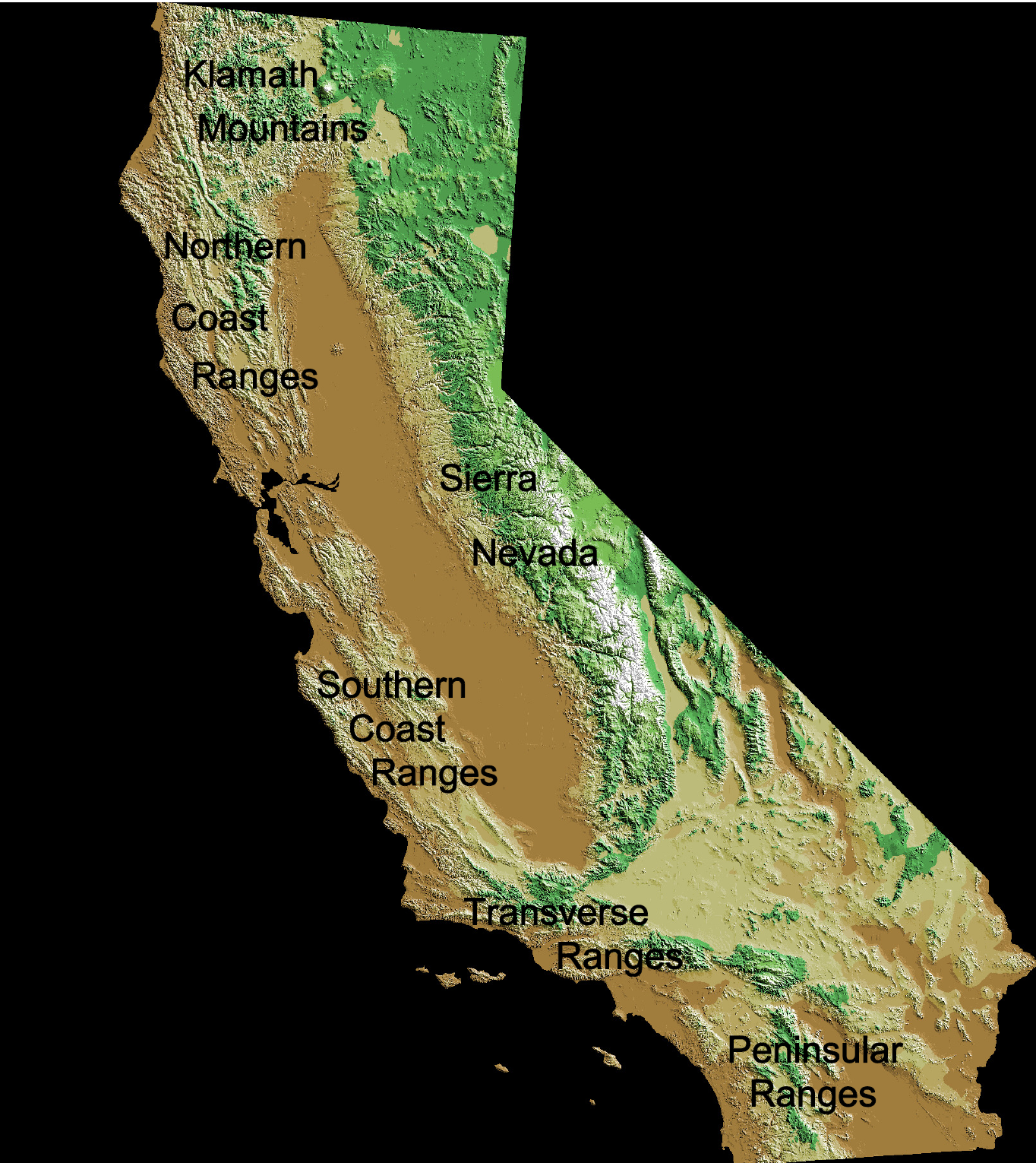
English: Mountain ranges of California:
Deutsch: Kalifornische Küstenketten |
| Sanasi | |
| Manba |
Original map: http://wwwflag.wr.usgs.gov/USGSFlag/Data/maps/ |
| Muallif |
Original map: USGS |
| Other versions |
Map:
This image is in the public domain in the United States because it only contains materials that originally came from the United States Geological Survey, an agency of the United States Department of the Interior. For more information, see the official USGS copyright policy.
|
Edits:
| This work has been released into the public domain by its author, Jo Weber. This applies worldwide. In some countries this may not be legally possible; if so: |
Fayl tarixi
Faylning biror paytdagi holatini koʻrish uchun tegishli sana/vaqtga bosingiz.
| Sana/Vaqt | Miniatura | Oʻlchamlari | Foydalanuvchi | Izoh | |
|---|---|---|---|---|---|
| joriy | 21:12, 3-May 2009 | | 1 364 × 1 530 (1,9 MB) | Jo Weber | {{Information |Description= {{en|California Coast Ranges}} {{de|Kalifornische Küstenketten}} |Source=File:Digital-elevation-map-california.gif |Date=2009-05-03 |Author=USGS / [[User:|Jo]] |Permission=see below |other_versions=[[:File:Digital-elevati |
Fayllarga ishoratlar
Bu faylga bogʻlangan sahifalar yoʻq.
Faylning global foydalanilishi
Ushbu fayl quyidagi vikilarda ishlatilyapti:
- cs.wikipedia.org loyihasida foydalanilishi
- de.wikipedia.org loyihasida foydalanilishi
- eo.wikipedia.org loyihasida foydalanilishi
- es.wikipedia.org loyihasida foydalanilishi
- frr.wikipedia.org loyihasida foydalanilishi
- fr.wikipedia.org loyihasida foydalanilishi
- it.wikipedia.org loyihasida foydalanilishi