Fayl:Carlisle aerial westward.jpg
Bu prevyuning hajmi: 800 × 600 piksel. Boshqa oʻlchamlari: 320 × 240 piksel | 640 × 480 piksel | 1 024 × 768 piksel | 1 280 × 960 piksel | 2 272 × 1 704 piksel.
Asl fayl (2 272 × 1 704 piksel, fayl hajmi: 1,78 MB, MIME tipi: image/jpeg)
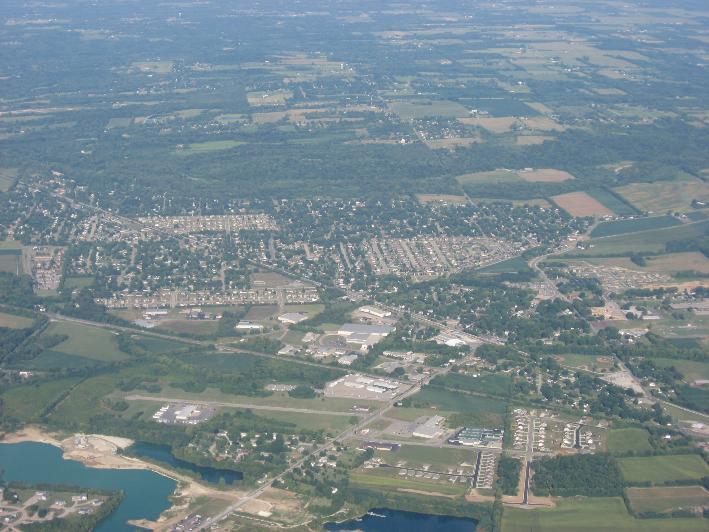
| Taʼrif | Aerial view of Carlisle, a city split between Montgomery and Warren counties in the southeastern part of the U.S. state of Ohio. Picture taken from a Diamond Eclipse light airplane at an altitude of 4,540 feet MSL and a bearing of approximately 270º. | ||
| Sanasi | Taken on 12 Avgust 2008 | ||
| Manba | Oʻzimning ishim | ||
| Muallif | Nyttend | ||
| Ruxsat (Bu faylning takror foydalanilishi) |
|
Fayl tarixi
Faylning biror paytdagi holatini koʻrish uchun tegishli sana/vaqtga bosingiz.
| Sana/Vaqt | Miniatura | Oʻlchamlari | Foydalanuvchi | Izoh | |
|---|---|---|---|---|---|
| joriy | 01:19, 19-Sentyabr 2008 | | 2 272 × 1 704 (1,78 MB) | Nyttend | {{Information |Description=Aerial view of {{w|Carlisle, Ohio|Carlisle}}, a city split between {{w|Montgomery County, Ohio|Montgomery}} and {{w|Warren County, Ohio|Warren}} counties in the southeastern part of the {{w|U.S. state}} of {{w|Ohio}}. Picture t |
Fayllarga ishoratlar
Bu faylga quyidagi sahifa bogʻlangan:
Faylning global foydalanilishi
Ushbu fayl quyidagi vikilarda ishlatilyapti:
- ar.wikipedia.org loyihasida foydalanilishi
- arz.wikipedia.org loyihasida foydalanilishi
- azb.wikipedia.org loyihasida foydalanilishi
- ca.wikipedia.org loyihasida foydalanilishi
- ceb.wikipedia.org loyihasida foydalanilishi
- cy.wikipedia.org loyihasida foydalanilishi
- de.wikipedia.org loyihasida foydalanilishi
- en.wikipedia.org loyihasida foydalanilishi
- es.wikipedia.org loyihasida foydalanilishi
- eu.wikipedia.org loyihasida foydalanilishi
- fa.wikipedia.org loyihasida foydalanilishi
- fr.wikipedia.org loyihasida foydalanilishi
- ht.wikipedia.org loyihasida foydalanilishi
- it.wikipedia.org loyihasida foydalanilishi
- ky.wikipedia.org loyihasida foydalanilishi
- lld.wikipedia.org loyihasida foydalanilishi
- pl.wikipedia.org loyihasida foydalanilishi
- pt.wikipedia.org loyihasida foydalanilishi
- sh.wikipedia.org loyihasida foydalanilishi
- simple.wikipedia.org loyihasida foydalanilishi
- sr.wikipedia.org loyihasida foydalanilishi
- uk.wikipedia.org loyihasida foydalanilishi
- ur.wikipedia.org loyihasida foydalanilishi
- vi.wikipedia.org loyihasida foydalanilishi
- www.wikidata.org loyihasida foydalanilishi
- zh-min-nan.wikipedia.org loyihasida foydalanilishi