Fayl:County Down UK location map.svg

Asl fayl (SVG fayl, asl oʻlchamlari 742 × 812 piksel, fayl hajmi: 1,73 MB)
| Taʼrif |
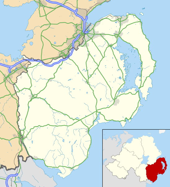
Map of County Down, UK with the following information shown:
Geographic limits:
|
|||
| Sanasi | ||||
| Manba |
Ordnance Survey of Northern Ireland OpenData
Ordnance Survey OpenData
|
|||
| Muallif | Nilfanion, created using OSNI data | |||
| Ruxsat (Bu faylning takror foydalanilishi) |
Bu fayl Creative Commons asosida litsenziyalangan Attribution- Share Alike 3.0 Unported litsenziyasi. Attributsiya: Contains LPS Intellectual Property and Ordnance Survey data © Crown copyright and database right 2016
|
Fayl tarixi
Faylning biror paytdagi holatini koʻrish uchun tegishli sana/vaqtga bosingiz.
| Sana/Vaqt | Miniatura | Oʻlchamlari | Foydalanuvchi | Izoh | |
|---|---|---|---|---|---|
| joriy | 12:45, 2016-yil 15-may | | 742 × 812 (1,73 MB) | Nilfanion | {{Information |Description=Map of County Down, UK with the following information shown: *Administrative borders *Coastline, lakes and rivers *Roads and railways *Urban areas Equirectangular map projection on WGS 84 datum, with N/S s... |
Fayllarga ishoratlar
Bu faylga quyidagi 2 sahifalar bogʻlangan:
Faylning global foydalanilishi
Ushbu fayl quyidagi vikilarda ishlatilyapti:
- en.wikipedia.org loyihasida foydalanilishi
- Downpatrick
- Newcastle, County Down
- Newtownards
- List of monastic houses in Ireland
- Bangor, County Down
- Dundrum, County Down
- Ardglass
- Donaghadee
- Warrenpoint
- Rostrevor
- Portaferry
- Kilkeel
- Killyleagh
- Comber
- Copeland Islands
- Royal Hillsborough
- Kircubbin, County Down
- Burr Point
- Carryduff
- Holywood, County Down
- Ballynahinch, County Down
- Crossgar
- Castlewellan
- Saintfield
- Annalong
- Slieve Donard
- Silent Valley Reservoir
- Magheralin
- Dromore, County Down
- Mayobridge
- Mazetown
- Hilltown, County Down
- Bangor Abbey
- Lurganare
- Millisle
- Ulster Folk and Transport Museums
- Dundonald, County Down
- Groomsport
- Ballela
- Kinallen
- Portavogie
- Bleary
- Gilford, County Down
- Loughinisland
- Strangford
- Páirc Esler
- Ballynoe, County Down
- Helen's Bay
- Rathfriland
- Cultra
Ushbu faylni koʻproq global foydalanishdan koʻring.