Fayl:Denmark North Jutland location map (ca).svg

Size of this PNG preview of this SVG file: 800 × 583 piksel. Boshqa oʻlchamlari: 320 × 233 piksel | 640 × 467 piksel | 1 024 × 746 piksel | 1 280 × 933 piksel | 2 560 × 1 866 piksel | 1 000 × 729 piksel.
Asl fayl (SVG fayl, asl oʻlchamlari 1 000 × 729 piksel, fayl hajmi: 158 KB)
.svg)
Qisqa izoh
| Taʼrif |
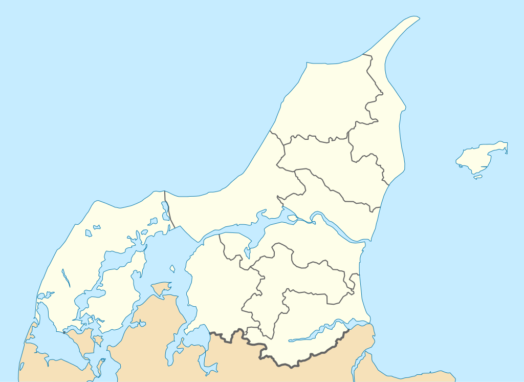
English: Location map of Region North Jutland in Denmark, color adjusted
Equirectangular projection, N/S stretching 185 %. Geographic limits of the map:
Deutsch: Positionskarte von der Region Nordjylland in Dänemark, Farben wurden angepasst
Quadratische Plattkarte, N-S-Streckung 185 %. Geographische Begrenzung der Karte:
|
| Sanasi | |
| Manba | Eigenes Werk (own work), derived from Denmark_North_Jutland_location_map.svg |
| Muallif | Erik Frohne |
| Other versions | Denmark_North_Jutland_location_map.svg |
Litsenziyalash
I, the copyright holder of this work, hereby publish it under the following licenses:

|
Ushbu hujjatdan nusxa ko‘chirish, tarqatish va/yoki o‘zgartirish uchun GNU Erkin guvohnoma litsenziyasi (GNU Free Documentation License), 1.2 va har qanday keyingi versiyalar shartlariga muvofiq ruxsat berilgan yoki Ochiq kodli dasturlar jamiyati (Free Software Foundation) tomonidan chop etilgan; oʻzgarmas boʻlimlarsiz, oldingi muqova matnlari va orqa muqova matnlarisiz. Litsenziya nusxasi GNU Erkin guvohnoma litsenziyasi (GNU Free Documentation License) boʻlimiga kiritilgan. |
Bu fayl Creative Commons asosida litsenziyalangan Attribution- Share Alike 3.0 Unported litsenziyasi.
- Siz erkinsiz:
- ulashishga – ishlanmani nusxalash, tarqatish va uzatish
- remiks qilishga – ishni moslashtirishga
- Quyidagi shartlar asosida:
- atribut – Siz tegishli litsenziyaga havolani taqdim etishingiz va oʻzgartirishlar kiritilganligini koʻrsatishingiz kerak. Siz buni har qanday oqilona yoʻl bilan qilishingiz mumkin, lekin litsenziar Sizni yoki Sizning foydalanishingizni ma'qullashini taklif qiladigan tarzda emas.
- bir xil ulashish – Agar Siz materialni remiks qilsangiz, oʻzgartirsangiz yoki unga asoslansangiz, oʻz hissalaringizni asl nusxadagi kabi bir xil yoki mos litsenziya ostida tarqatishingiz kerak.
Siz oʻzingiz xohlagan litsenziyani tanlashingiz mumkin.
Fayl tarixi
Faylning biror paytdagi holatini koʻrish uchun tegishli sana/vaqtga bosingiz.
| Sana/Vaqt | Miniatura | Oʻlchamlari | Foydalanuvchi | Izoh | |
|---|---|---|---|---|---|
| joriy | 13:05, 13-Yanvar 2010 | | 1 000 × 729 (158 KB) | Erik Frohne | == {{int:filedesc}} == {{Information |Description={{en|1=Location map of Region North Jutland in Denmark, color adjusted Equirectangular projection, N/S stretching 185 %. Geographic limits of the map: * N: 57.80° N * S: 56.50° N * W: 8.00° E * E: 11 |
Fayllarga ishoratlar
Bu faylga quyidagi 2 sahifalar bogʻlangan:
Faylning global foydalanilishi
Ushbu fayl quyidagi vikilarda ishlatilyapti:
- da.wikipedia.org loyihasida foydalanilishi
- Aalborg
- Aggersborg
- Nykøbing Mors
- Klitmøller
- Kokkedal Slot (Nordjylland)
- Nibe
- Nordsøen Oceanarium
- Nørresundby
- Rold
- Fyrkat
- Højriis
- Frederikshavn
- Hjørring
- Farsø
- Arden
- Skagen
- Thisted
- Hanstholm
- Hirtshals
- Kvissel
- Ørum (Brønderslev Kommune)
- Klokkerholm
- Lønstrup
- Lille Arden
- Vesterø Havn
- Hou (Vendsyssel)
- Hadsund
- Aggersborg Kirke
- Lodbjerg Kirke
- Lønstrup Kirke
- Mårup Kirke
- Ørum Kirke (Thisted Kommune)
- Sankt Markus Kirke (Aalborg)
- Sankt Olai Kirke (Hjørring)
- Skagen Kirke
- Thisted Kirke
- Vennebjerg Kirke
- Vestervig Kirke
- Valsgaard Kirke
- Hallund (Brønderslev Kommune)
- Den tilsandede kirke
- Bangsbostrand Kirke
- Jerup Kirke
- Gistrup
- Hobro Kirke
- Elling Kirke
- Løgstør
- Lundby (Aalborg Kommune-Gunderup Sogn)
- Strandby Kirke (Frederikshavn Kommune)
- Vejgaard
Ushbu faylni koʻproq global foydalanishdan koʻring.
.svg)
.svg)