Fayl:Denmark South Denmark location map (da).svg

Size of this PNG preview of this SVG file: 783 × 600 piksel. Boshqa oʻlchamlari: 313 × 240 piksel | 627 × 480 piksel | 1 003 × 768 piksel | 1 280 × 980 piksel | 2 560 × 1 961 piksel | 1 000 × 766 piksel.
Asl fayl (SVG fayl, asl oʻlchamlari 1 000 × 766 piksel, fayl hajmi: 252 KB)
.svg)
Qisqa izoh
| Taʼrif |
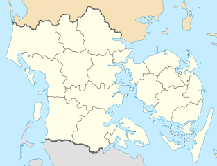
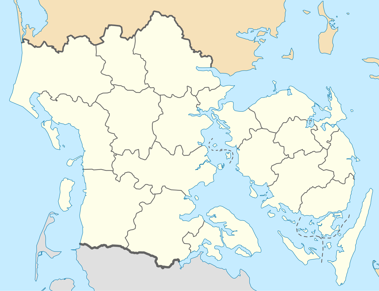
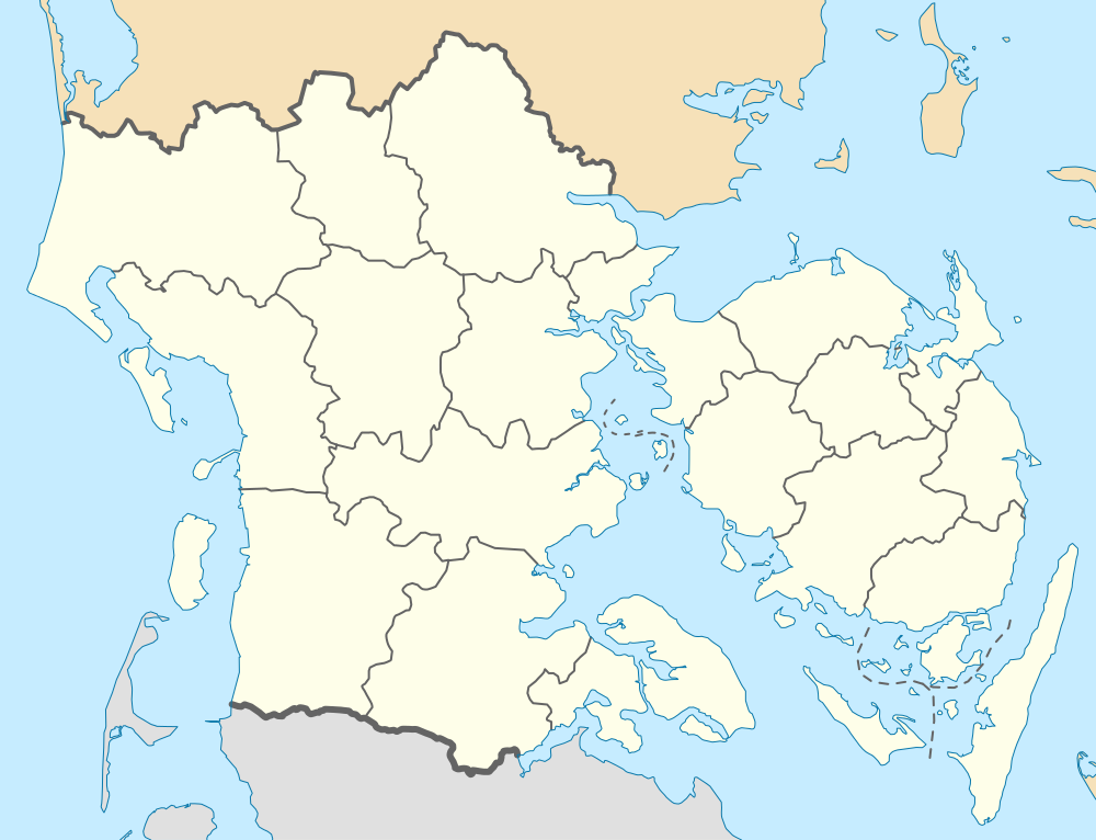
English: Location map of Region South Denmark in Denmark, color adjusted
Equirectangular projection, N/S stretching 177 %. Geographic limits of the map:
Deutsch: Positionskarte von der Region Syddanmark in Dänemark, Farben wurden angepasst
Quadratische Plattkarte, N-S-Streckung 177 %. Geographische Begrenzung der Karte:
Dansk: Positionskort over Region Syddanmark, farverne er justeret.
Kvadratisk udsnit, N-S-strækning 177 %. Geografiske begrænsninger på kortet:
|
| Sanasi | |
| Manba | Oʻzimning ishim, derived from Denmark_South_Denmark_location_map.svg |
| Muallif | Erik Frohne |
| Other versions | Denmark South Denmark location map.svg |
| SVG genesis |
Litsenziyalash
I, the copyright holder of this work, hereby publish it under the following licenses:

|
Ushbu hujjatdan nusxa ko‘chirish, tarqatish va/yoki o‘zgartirish uchun GNU Erkin guvohnoma litsenziyasi (GNU Free Documentation License), 1.2 va har qanday keyingi versiyalar shartlariga muvofiq ruxsat berilgan yoki Ochiq kodli dasturlar jamiyati (Free Software Foundation) tomonidan chop etilgan; oʻzgarmas boʻlimlarsiz, oldingi muqova matnlari va orqa muqova matnlarisiz. Litsenziya nusxasi GNU Erkin guvohnoma litsenziyasi (GNU Free Documentation License) boʻlimiga kiritilgan. |
Bu fayl Creative Commons asosida litsenziyalangan Attribution- Share Alike 3.0 Unported litsenziyasi.
- Siz erkinsiz:
- ulashishga – ishlanmani nusxalash, tarqatish va uzatish
- remiks qilishga – ishni moslashtirishga
- Quyidagi shartlar asosida:
- atribut – Siz tegishli litsenziyaga havolani taqdim etishingiz va oʻzgartirishlar kiritilganligini koʻrsatishingiz kerak. Siz buni har qanday oqilona yoʻl bilan qilishingiz mumkin, lekin litsenziar Sizni yoki Sizning foydalanishingizni ma'qullashini taklif qiladigan tarzda emas.
- bir xil ulashish – Agar Siz materialni remiks qilsangiz, oʻzgartirsangiz yoki unga asoslansangiz, oʻz hissalaringizni asl nusxadagi kabi bir xil yoki mos litsenziya ostida tarqatishingiz kerak.
Siz oʻzingiz xohlagan litsenziyani tanlashingiz mumkin.
Fayl tarixi
Faylning biror paytdagi holatini koʻrish uchun tegishli sana/vaqtga bosingiz.
| Sana/Vaqt | Miniatura | Oʻlchamlari | Foydalanuvchi | Izoh | |
|---|---|---|---|---|---|
| joriy | 13:26, 13-Yanvar 2010 | | 1 000 × 766 (252 KB) | Erik Frohne | == {{int:filedesc}} == {{Information |Description={{en|1=Location map of Region South Denmark in Denmark, color adjusted Equirectangular projection, N/S stretching 177 %. Geographic limits of the map: * N: 56.00° N * S: 54.70° N * W: 8.00° E * E: 11 |
Fayllarga ishoratlar
Bu faylga quyidagi 2 sahifalar bogʻlangan:
Faylning global foydalanilishi
Ushbu fayl quyidagi vikilarda ishlatilyapti:
- da.wikipedia.org loyihasida foydalanilishi
- Esbjerg
- Odense
- Ribe
- Illum (ø)
- Aabenraa
- Dræet
- Æbeløholm
- Assens
- Christiansfeld
- Egeskov Slot
- Fredericia
- Frøslevlejren
- Haderslev Domkirke
- Hagenskov
- Helnæs Fyr
- Marstal
- Middelfart
- Fanø
- Thurø
- Ribe Domkirke
- Sankt Nicolai Kirke (Aabenraa)
- Styrtom
- Tønder
- Billund
- Vorbasse
- Ravningbroen
- Vojens
- Nyborg
- Svendborg
- Svendborgsund
- Rudkøbing
- Seden
- Sønderborg Slot
- Kolding
- Vejle
- Sankt Knuds Kirke (Odense)
- Ærøskøbing
- Strynø
- Ho (by)
- Nyborg Gymnasium
- Kerteminde
- Billund Lufthavn
- Sønderborg
- Tinglev
- Padborg
- Mølholm (Vejle)
- Odense Zoo
- Tarp (Esbjerg Kommune)
- Tandslet
- Birkholm
Ushbu faylni koʻproq global foydalanishdan koʻring.
.svg)
.svg)