Fayl:Granada-loc.svg

Size of this PNG preview of this SVG file: 512 × 452 piksel. Boshqa oʻlchamlari: 272 × 240 piksel | 544 × 480 piksel | 870 × 768 piksel | 1 160 × 1 024 piksel | 2 320 × 2 048 piksel.
Asl fayl (SVG fayl, asl oʻlchamlari 512 × 452 piksel, fayl hajmi: 490 KB)
Qisqa izoh
| Taʼrif |
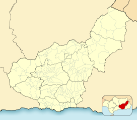
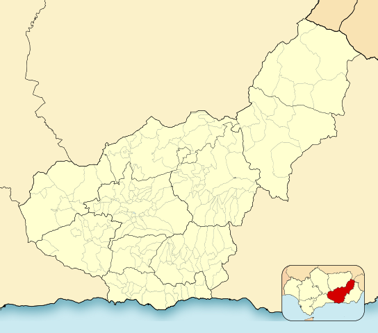
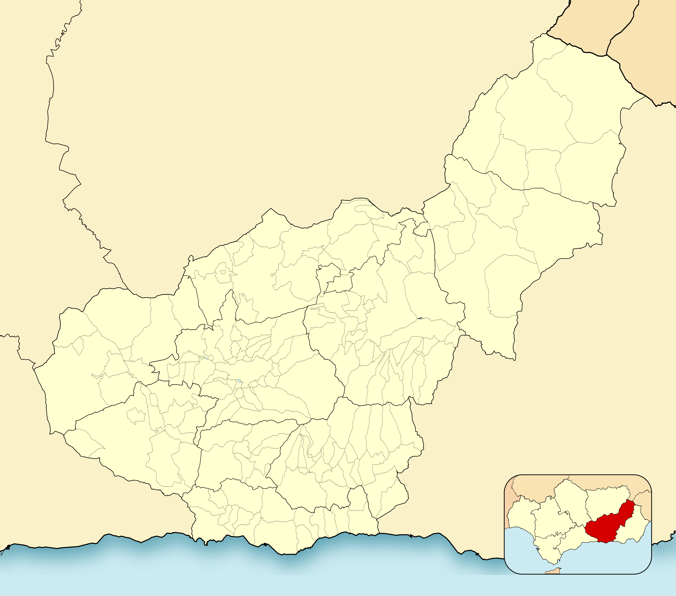
English: Location map of Province of Granada
Equirectangular projection, N/S stretching 130 %. Geographic limits of the map:
Español: Mapa de localización de la Provincia de Granada
Proyección equirrectangular, N/S estirada 130 %. Límites geográficos del mapa:
|
|
| Sanasi | ||
| Manba | Own work based on: EspañaLoc.svg by HansenBCN | |
| Muallif | Miguillen | |
| SVG genesis | This locator map was created with Inkscape.
|
Litsenziyalash
Miguillen, the copyright holder of this work, hereby publishes it under the following license:
Bu fayl Creative Commons asosida litsenziyalangan Attribution- Share Alike 3.0 Unported litsenziyasi.
Attributsiya: Miguillen
- Siz erkinsiz:
- ulashishga – ishlanmani nusxalash, tarqatish va uzatish
- remiks qilishga – ishni moslashtirishga
- Quyidagi shartlar asosida:
- atribut – Siz tegishli litsenziyaga havolani taqdim etishingiz va oʻzgartirishlar kiritilganligini koʻrsatishingiz kerak. Siz buni har qanday oqilona yoʻl bilan qilishingiz mumkin, lekin litsenziar Sizni yoki Sizning foydalanishingizni ma'qullashini taklif qiladigan tarzda emas.
- bir xil ulashish – Agar Siz materialni remiks qilsangiz, oʻzgartirsangiz yoki unga asoslansangiz, oʻz hissalaringizni asl nusxadagi kabi bir xil yoki mos litsenziya ostida tarqatishingiz kerak.
Fayl tarixi
Faylning biror paytdagi holatini koʻrish uchun tegishli sana/vaqtga bosingiz.
| Sana/Vaqt | Miniatura | Oʻlchamlari | Foydalanuvchi | Izoh | |
|---|---|---|---|---|---|
| joriy | 20:52, 2-Yanvar 2023 | | 512 × 452 (490 KB) | Lopezsuarez | Reverted to version as of 14:26, 6 April 2022 (UTC) |
| 20:51, 2-Yanvar 2023 |  | 512 × 452 (490 KB) | Lopezsuarez | Reverted to version as of 16:02, 9 December 2010 (UTC) | |
| 14:26, 6-Aprel 2022 |  | 512 × 452 (490 KB) | Lopezsuarez | Reverted to version as of 16:04, 9 December 2010 (UTC) | |
| 11:38, 4-Aprel 2022 |  | 512 × 452 (1,55 MB) | NACLE | quito el marco | |
| 11:35, 4-Aprel 2022 |  | 512 × 452 (1,57 MB) | NACLE | añado nuevos municipios | |
| 16:04, 9-Dekabr 2010 |  | 512 × 452 (490 KB) | Miguillen | defecto | |
| 16:02, 9-Dekabr 2010 |  | 512 × 452 (490 KB) | Miguillen | colores y mosca según convención | |
| 15:27, 14-Avgust 2010 |  | 512 × 452 (390 KB) | Miguillen | marco | |
| 10:03, 20-May 2010 |  | 512 × 452 (356 KB) | Miguillen | efecto trazo | |
| 10:21, 19-May 2010 |  | 512 × 452 (354 KB) | Miguillen | == {{int:filedesc}} == {{Information |Description={{en|Location map of Province of Granada}} Equirectangular projection, N/S stretching 130 %. Geographic limits of the map: * N: ° N * S: ° N * W: ° O * E: ° O {{es|Mapa |
Fayllarga ishoratlar
Bu faylga quyidagi 2 sahifalar bogʻlangan:
Faylning global foydalanilishi
Ushbu fayl quyidagi vikilarda ishlatilyapti:
- ar.wikipedia.org loyihasida foydalanilishi
- ba.wikipedia.org loyihasida foydalanilishi
- ceb.wikipedia.org loyihasida foydalanilishi
- de.wikipedia.org loyihasida foydalanilishi
- en.wikipedia.org loyihasida foydalanilishi
- Sexi (Phoenician colony)
- Órgiva
- Bubión
- Motril
- Guadix
- Alhama de Granada
- Salobreña
- Jabalcón
- Santa Fe, Granada
- Albuñán
- Benalúa de las Villas
- Castril
- Las Gabias
- La Zubia
- Loja, Granada
- Veleta (Sierra Nevada)
- Galera, Granada
- Battle of Moclín (1280)
- Module:Location map/data/Spain Province of Granada/doc
- Torrenueva Costa
- Module:Location map/data/Spain Province of Granada
- Fornes, Granada
- Játar
- eo.wikipedia.org loyihasida foydalanilishi
Ushbu faylni koʻproq global foydalanishdan koʻring.