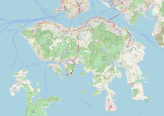
Fayl:Location map Hong Kong Island.png

Bu prevyuning hajmi: 800 × 566 piksel. Boshqa oʻlchamlari: 320 × 226 piksel | 640 × 453 piksel | 1 024 × 724 piksel | 1 280 × 905 piksel | 2 560 × 1 810 piksel | 6 211 × 4 392 piksel.
Asl fayl (6 211 × 4 392 piksel, fayl hajmi: 13,09 MB, MIME tipi: image/png)
Qisqa izoh
| Description |
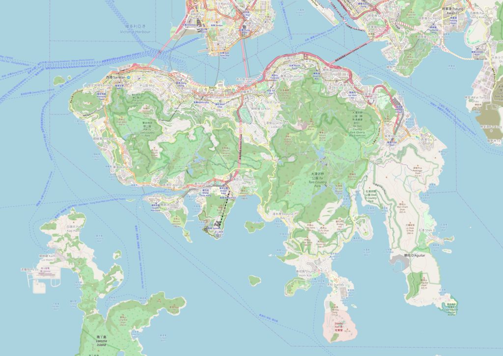
This map was created from OpenStreetMap project data, collected by the community. This map may be incomplete, and may contain errors. Don't rely solely on it for navigation. |
|||||||||
| Sanasi | (see file history) | |||||||||
| Manba | You may find a page on the OpenStreetMap wiki page for Hong Kong Island | |||||||||
| Yaratuvchi |
OpenStreetMap contributors |
|||||||||
| Ruxsat (Bu faylning takror foydalanilishi) |
OpenStreetMap data is available under the Open Database License (details). Map tiles are licensed under the Creative Commons Attribution-ShareAlike 2.0 license (CC-BY-SA 2.0).
This file is licensed under the Creative Commons Attribution-Share Alike 2.0 Generic license.
|
|||||||||
| Geotemporal data | ||||||||||
| Bounding box |
|
|||||||||
| Georeferencing | If inappropriate please set warp_status = skip to hide. | |||||||||
Fayl tarixi
Faylning biror paytdagi holatini koʻrish uchun tegishli sana/vaqtga bosingiz.
| Sana/Vaqt | Miniatura | Oʻlchamlari | Foydalanuvchi | Izoh | |
|---|---|---|---|---|---|
| joriy | 08:20, 12-Noyabr 2018 | | 6 211 × 4 392 (13,09 MB) | Jc86035 | 2018 version |
| 15:36, 21-Aprel 2017 |  | 5 823 × 4 118 (10,32 MB) | Jc86035 | 2017 version | |
| 13:25, 2-Avgust 2016 |  | 2 329 × 1 647 (2,13 MB) | Wright.one | 2016 version | |
| 04:16, 25-Aprel 2015 |  | 2 329 × 1 647 (1,98 MB) | Wright.one | 2015 version | |
| 11:28, 5-Aprel 2014 |  | 2 329 × 1 647 (1,95 MB) | Jc86035 | minor | |
| 15:05, 4-Aprel 2014 |  | 2 329 × 1 647 (1,95 MB) | Jc86035 | Updated (wow, such improve), resolution up to maximum (1:32000) | |
| 15:47, 3-May 2010 |  | 1 367 × 967 (584 KB) | Dr. Blofeld~commonswiki | {{Information |Description={{en|1=j}} |Source=j |Author=j |Date=j |Permission= |other_versions= }} |
Fayllarga ishoratlar
Bu faylga quyidagi 2 sahifalar bogʻlangan:
Faylning global foydalanilishi
Ushbu fayl quyidagi vikilarda ishlatilyapti:
- ar.wikipedia.org loyihasida foydalanilishi
- ceb.wikipedia.org loyihasida foydalanilishi
- de.wikipedia.org loyihasida foydalanilishi
- en.wikipedia.org loyihasida foydalanilishi
- Government House, Hong Kong
- Victoria Park (Hong Kong)
- Central station (MTR)
- Admiralty station (MTR)
- Hong Kong station
- Yau Tong station
- Sai Ying Pun station
- Sheung Wan station
- Wan Chai station
- Causeway Bay station
- Tin Hau station
- Fortress Hill station
- North Point station
- Quarry Bay station
- Tai Koo station
- Sai Wan Ho station
- Shau Kei Wan station
- Heng Fa Chuen station
- Chai Wan station
- Exhibition Centre station (MTR)
- Kowloon station (MTR)
- Tamar station
- HKU station
- Kennedy Town station
- Mount Davis, Hong Kong
- Mandarin Oriental, Hong Kong
- Southorn Playground
- Four Seasons Hotel Hong Kong
- South China AA Stadium
- Ocean Park station
- Wong Chuk Hang station
- Lei Tung station
- South Horizons station
- Wheelock House
- Lung King Heen
- W Hong Kong
- L'Atelier de Joël Robuchon (Hong Kong)
- Jamia Mosque (Hong Kong)
- Module:Location map/data/Hong Kong Island/doc
- Hung Shing Yeh Beach
- Causeway Bay North station
- Occupy Central (2011–2012)
- User:Priscillasuen/sandbox
- User:KX675/Sandbox
- Ammar Mosque and Osman Ramju Sadick Islamic Centre
- Stanley Mosque
Ushbu faylni koʻproq global foydalanishdan koʻring.