Fayl:Map of Russia - Ural Federal District (2018 composition).svg

Size of this PNG preview of this SVG file: 800 × 462 piksel. Boshqa oʻlchamlari: 320 × 185 piksel | 640 × 369 piksel | 1 024 × 591 piksel | 1 280 × 738 piksel | 2 560 × 1 477 piksel | 1 092 × 630 piksel.
Asl fayl (SVG fayl, asl oʻlchamlari 1 092 × 630 piksel, fayl hajmi: 61 KB)
.svg)
Qisqa izoh
| Taʼrif |
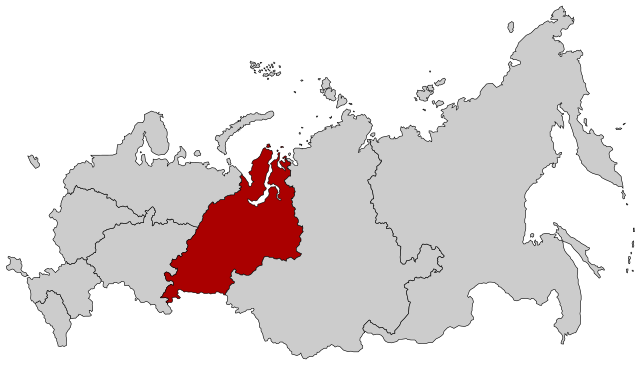
English: Map Russia highlighting the Ural Federal district as of 2018-11-03. Español: Ubicación del Distrito Federal de los Urales en la Federación Rusa Русский: Уральский федеральный округ |
| Sanasi | (UTC) |
| Manba |
This file was derived from: |
| Muallif |
.svg)
| This is a retouched picture, which means that it has been digitally altered from its original version. Modifications: Change of Far Eastern and Siberian district membership. The original can be viewed here: Map of Russia - Far Eastern Federal District (2018 composition).svg:
|
Litsenziyalash
This file is licensed under the Creative Commons Attribution-Share Alike 2.5 Generic license.
- Siz erkinsiz:
- ulashishga – ishlanmani nusxalash, tarqatish va uzatish
- remiks qilishga – ishni moslashtirishga
- Quyidagi shartlar asosida:
- atribut – Siz tegishli litsenziyaga havolani taqdim etishingiz va oʻzgartirishlar kiritilganligini koʻrsatishingiz kerak. Siz buni har qanday oqilona yoʻl bilan qilishingiz mumkin, lekin litsenziar Sizni yoki Sizning foydalanishingizni ma'qullashini taklif qiladigan tarzda emas.
- bir xil ulashish – Agar Siz materialni remiks qilsangiz, oʻzgartirsangiz yoki unga asoslansangiz, oʻz hissalaringizni asl nusxadagi kabi bir xil yoki mos litsenziya ostida tarqatishingiz kerak.
Original upload log
This image is a derivative work of the following images:
- File:Map of Russia - Urals Federal District.svg licensed with Cc-by-sa-2.5
- 2015-03-10T14:20:10Z Knyaz-1988 1092x630 (97434 Bytes) Reverted to version as of 22:07, 3 November 2014
- 2014-11-04T01:32:38Z Fry1989 1092x630 (120528 Bytes) NPOV issue.
- 2014-11-03T22:07:29Z Knyaz-1988 1092x630 (97434 Bytes) New version
- 2010-01-21T22:28:10Z Denhud 1092x630 (120528 Bytes) On 2010-01-19 Southern Federal District split in two, with its former southern territories forming new North Caucasian Federal District.
- 2008-03-03T23:37:06Z Lokal Profil 1092x630 (114976 Bytes) {{Information |Description=Map Russia highlighting the Urals [[:en:Federal districts of Russia|Federal districts]]. |Source=Based on [[:Image:Map of Russian subjects, 2008-03-01.svg|Map of Russian subjects, 2008-03-01.svg]] b
- File:Map of Russia - Far Eastern Federal District (2018 composition).svg licensed with Cc-by-sa-2.5
- 2018-11-04T19:15:28Z Seryo93 1092x630 (62312 Bytes) == {{int:filedesc}} == {{Information |Description={{en|Map Russia highlighting the '''Far Eastern [[:en:Federal districts of Russia|Federal district]]''' as of 2018-11-03.}} {{es|Ubicación del Distrito Federal de Lejano Orie
Uploaded with derivativeFX
Fayl tarixi
Faylning biror paytdagi holatini koʻrish uchun tegishli sana/vaqtga bosingiz.
| Sana/Vaqt | Miniatura | Oʻlchamlari | Foydalanuvchi | Izoh | |
|---|---|---|---|---|---|
| joriy | 13:59, 2-Dekabr 2018 | | 1 092 × 630 (61 KB) | Seryo93 | == {{int:filedesc}} == {{Information |Description={{en|Map Russia highlighting the Ural Federal district as of 2018-11-03.}} {{es|Ubicación del Distrito Federal de los Urales en la Federación Rusa}} {{Ru|Уральский федеральный округ}} |Source={{Derived from|Map of Russia - Urals Federal District.svg|Map of Russia - Far Eastern Federal District (2018 composition).svg|display=50}} |Date=2018-12-02 13:58 (UTC) |Author= * [[:File:Map of Russia - Urals Federal Di... |
Fayllarga ishoratlar
Bu faylga quyidagi sahifa bogʻlangan:
Faylning global foydalanilishi
Ushbu fayl quyidagi vikilarda ishlatilyapti:
- cs.wikipedia.org loyihasida foydalanilishi
- cv.wikipedia.org loyihasida foydalanilishi
- en.wikipedia.org loyihasida foydalanilishi
- en.wikinews.org loyihasida foydalanilishi
- frr.wikipedia.org loyihasida foydalanilishi
- fr.wikipedia.org loyihasida foydalanilishi
- lld.wikipedia.org loyihasida foydalanilishi
- lt.wikipedia.org loyihasida foydalanilishi
- lv.wikipedia.org loyihasida foydalanilishi
- no.wikipedia.org loyihasida foydalanilishi
- ru.wikipedia.org loyihasida foydalanilishi
- sl.wikipedia.org loyihasida foydalanilishi
- ta.wikipedia.org loyihasida foydalanilishi
- vi.wikipedia.org loyihasida foydalanilishi
- wuu.wikipedia.org loyihasida foydalanilishi
.svg)