Fayl:Marodi Jeh location map relief.svg

Size of this PNG preview of this SVG file: 429 × 582 piksel. Boshqa oʻlchamlari: 177 × 240 piksel | 354 × 480 piksel | 566 × 768 piksel | 755 × 1 024 piksel | 1 509 × 2 048 piksel.
Asl fayl (SVG fayl, asl oʻlchamlari 429 × 582 piksel, fayl hajmi: 381 KB)
Qisqa izoh
| Taʼrif |
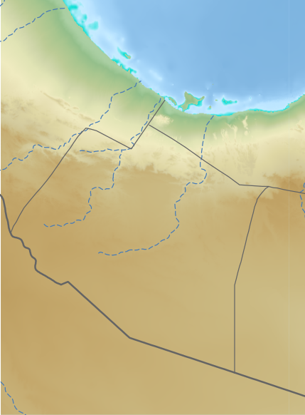
English: Relief map of Marodi Jeh, for geo-location purposes
|
| Sanasi | |
| Manba | See below |
| Muallif | See below (Assembly by User:Freetrashbox) |
Sources
- Global Relief: ETOPO Global Relief Model / NOAA (2022-10-04). Ice surface elevation geotiff. Retrieved on 2022-12-13. / ETOPO_2022_v1_15s_N00W030_surface.tif, ETOPO_2022_v1_15s_N15E030_surface.tif
- International border: GSHHG data version 2.3.7 / NOAA (2017-06-15). Shoreline / Coastline Resources. Retrieved on 2022-12-13. / gshhg-shp-2.3.7\WDBII_shp\h\WDBII_border_h_L1.shp
- Intermittent rivers: GSHHG data version 2.3.7 / ibid. / gshhg-shp-2.3.7\WDBII_shp\h\WDBII_river_h_L08.shp
- Regional border of Somaliland: SOMALILAND VULNERABILITY INDEX MAP / Ministry of Planning and National Development of Somaliland. SOMALILAND VULNERABILITY INDEX MAP. Retrieved on 2022-12-13.
Design
- Global Relief: Wikipedia:Graphics Lab/Resources/GIS sources and palettes
- International border: R100 G100 B100, 2pts.
- Intermittent rivers: R72 G123 B182, 1pt, dash 5 pts, blank 3pts.
- Regional border of Somaliland: R100 G100 B100, 1pt.
Litsenziyalash
This image is in the public domain because it contains materials that originally came from the U.S. National Oceanic and Atmospheric Administration, taken or made as part of an employee's official duties.
|
Fayl tarixi
Faylning biror paytdagi holatini koʻrish uchun tegishli sana/vaqtga bosingiz.
| Sana/Vaqt | Miniatura | Oʻlchamlari | Foydalanuvchi | Izoh | |
|---|---|---|---|---|---|
| joriy | 11:31, 13-Dekabr 2022 | | 429 × 582 (381 KB) | Freetrashbox | Uploaded a work by NOAA from https://www.ngdc.noaa.gov/mgg/global/relief/ETOPO2022/data/15s/15s_surface_elev_gtif/ with UploadWizard |
Fayllarga ishoratlar
Bu faylga quyidagi 2 sahifalar bogʻlangan:
Faylning global foydalanilishi
Ushbu fayl quyidagi vikilarda ishlatilyapti:
- en.wikipedia.org loyihasida foydalanilishi
- fr.wikipedia.org loyihasida foydalanilishi
- si.wikipedia.org loyihasida foydalanilishi