Fayl:NZ-West Coast plain map.png
Bundan kattaroq tasvir yoʻq.
NZ-West_Coast_plain_map.png (378 × 423 piksel, fayl hajmi: 21 KB, MIME tipi: image/png)
Qisqa izoh
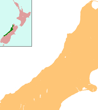
| Taʼrif | Locator map for West Coast Region, New Zealand |
| Sanasi | |
| Manba | combination of Image:NZ-SI plain map.png and Image:Position of West Coast.png |
| Muallif | Grutness |
| Ruxsat (Bu faylning takror foydalanilishi) |
public domain |
Litsenziyalash
| I, the copyright holder of this work, release this work into the public domain. This applies worldwide. In some countries this may not be legally possible; if so: I grant anyone the right to use this work for any purpose, without any conditions, unless such conditions are required by law. |
Fayl tarixi
Faylning biror paytdagi holatini koʻrish uchun tegishli sana/vaqtga bosingiz.
| Sana/Vaqt | Miniatura | Oʻlchamlari | Foydalanuvchi | Izoh | |
|---|---|---|---|---|---|
| joriy | 13:25, 17-Iyul 2008 | | 378 × 423 (21 KB) | Grutness | {{Information |Description=== Summary == {{Information |Description=Locator map for West Coast Region, New Zealand |Source=combination of Image:NZ-SI plain map.png and Image:Position of West Coast.png |Date=17 July 2008 |Author=Grutness |Permiss |
Fayllarga ishoratlar
Bu faylga quyidagi 2 sahifalar bogʻlangan:
Faylning global foydalanilishi
Ushbu fayl quyidagi vikilarda ishlatilyapti:
- ar.wikipedia.org loyihasida foydalanilishi
- ceb.wikipedia.org loyihasida foydalanilishi
- en.wikipedia.org loyihasida foydalanilishi
- Kokiri
- Punakaiki
- Franz Josef Glacier
- Crushington, New Zealand
- Lake Christabel
- Brunner, New Zealand
- Hokitika Airport
- Lendenfeld Peak
- Ngahere
- Cronadun
- Te Kuha
- Lake Ianthe
- Pukekura
- Lake Poerua
- Inchbonnie
- Ruatapu, New Zealand
- Lake Mahinapua
- Whataroa River
- Whataroa
- Stillwater, West Coast
- Westport Airport (New Zealand)
- Millerton, New Zealand
- Stockton, New Zealand
- Seddonville
- Summerlea, New Zealand
- Sergeants Hill
- List of schools in the West Coast, New Zealand
- Lake Daniell
- Module:Location map/data/New Zealand West Coast/doc
- Maruia
- Haupiri
- Kokatahi
- Lyell, New Zealand
- Waiuta
- Mount Rolleston
- User:Sladew/Charles Edward Douglas
- Charlie Douglas
- Mount Cook Aerodrome
- Mokihinui
- Module:Location map/data/New Zealand West Coast
- Agassiz Glacier (New Zealand)
- Wallsend, New Zealand
- Dunollie, New Zealand
- Ballroom Overhang
- Pancake Rocks and Blowholes
- Ōtūmahana Estuary
- Gates of Haast
- fa.wikipedia.org loyihasida foydalanilishi
Ushbu faylni koʻproq global foydalanishdan koʻring.