Fayl:Nepal zones.png
Bu prevyuning hajmi: 800 × 534 piksel. Boshqa oʻlchamlari: 320 × 213 piksel | 640 × 427 piksel | 1 024 × 683 piksel | 1 280 × 854 piksel | 1 600 × 1 067 piksel.
Asl fayl (1 600 × 1 067 piksel, fayl hajmi: 112 KB, MIME tipi: image/png)
Qisqa izoh
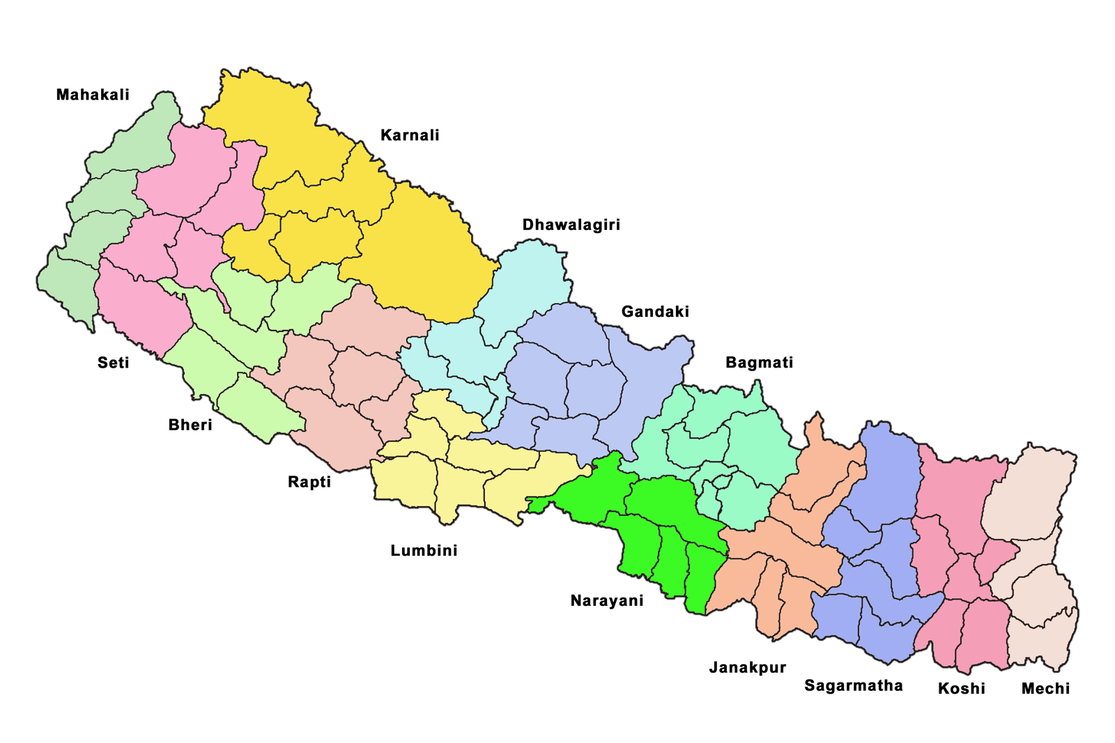
| Taʼrif | Map of the zones of Nepal. Created by Summit Raj Tuladhar, on 23 January 2007 for public domain use |
| Sanasi | |
| Manba | en:image:Nepal_zones.png |
| Muallif | w:en:user:summitraj |

|
File:Nepal zones.svg is a vector version of this file. It should be used in place of this PNG file when not inferior.
File:Nepal zones.png → File:Nepal zones.svg
For more information, see Help:SVG. |
 |
Litsenziyalash

|
The copyright holder of this work allows anyone to use it for any purpose including unrestricted redistribution, commercial use, and modification.
Usage notes:
|
Fayl tarixi
Faylning biror paytdagi holatini koʻrish uchun tegishli sana/vaqtga bosingiz.
| Sana/Vaqt | Miniatura | Oʻlchamlari | Foydalanuvchi | Izoh | |
|---|---|---|---|---|---|
| joriy | 11:28, 1-Aprel 2007 | | 1 600 × 1 067 (112 KB) | Ellery | {{Information |Description=Map of the zones of Nepal. Created by Summit Raj Tuladhar, on 23 January 2007 for public domain use |Source=en:image:Nepal_zones.png |Date=23 January 2007 |Author=w:en:user:summitraj |Permission= |
Fayllarga ishoratlar
Bu faylga quyidagi 3 sahifalar bogʻlangan:
Faylning global foydalanilishi
Ushbu fayl quyidagi vikilarda ishlatilyapti:
- bg.wikipedia.org loyihasida foydalanilishi
- dty.wikipedia.org loyihasida foydalanilishi
- el.wikipedia.org loyihasida foydalanilishi
- en.wikipedia.org loyihasida foydalanilishi
- eo.wikipedia.org loyihasida foydalanilishi
- fi.wikipedia.org loyihasida foydalanilishi
- it.wikipedia.org loyihasida foydalanilishi
- lt.wikipedia.org loyihasida foydalanilishi
- mai.wikipedia.org loyihasida foydalanilishi
- ne.wikipedia.org loyihasida foydalanilishi
- sa.wikipedia.org loyihasida foydalanilishi
- sv.wikipedia.org loyihasida foydalanilishi
- ta.wikipedia.org loyihasida foydalanilishi
- www.wikidata.org loyihasida foydalanilishi