Fayl:Satellite imagery of Ras Rakan 2007.jpg
Bundan kattaroq tasvir yoʻq.
Satellite_imagery_of_Ras_Rakan_2007.jpg (522 × 356 piksel, fayl hajmi: 54 KB, MIME tipi: image/jpeg)
Qisqa izoh
| Taʼrif |
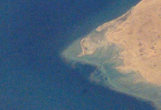
English: Satellite imagery of northern Qatari Peninsula taken by NASA in 2007. |
| Sanasi | |
| Manba | https://eol.jsc.nasa.gov/SearchPhotos/photo.pl?mission=ISS014&roll=E&frame=16335 |
| Muallif | NASA |
| Other versions |

Litsenziyalash
| This file is in the public domain in the United States because it was solely created by NASA. NASA copyright policy states that "NASA material is not protected by copyright unless noted". (See Template:PD-USGov, NASA copyright policy page or JPL Image Use Policy.) | ||
 |
Warnings:
|
Fayl tarixi
Faylning biror paytdagi holatini koʻrish uchun tegishli sana/vaqtga bosingiz.
| Sana/Vaqt | Miniatura | Oʻlchamlari | Foydalanuvchi | Izoh | |
|---|---|---|---|---|---|
| joriy | 10:32, 8-Yanvar 2019 | | 522 × 356 (54 KB) | Elspamo4 | File:Satellite imagery of northern Qatari Peninsula 2007.jpg cropped 83 % horizontally, 83 % vertically using CropTool with precise mode. |
Fayllarga ishoratlar
Bu faylga quyidagi sahifa bogʻlangan:
Faylning global foydalanilishi
Ushbu fayl quyidagi vikilarda ishlatilyapti:
- ar.wikipedia.org loyihasida foydalanilishi
- en.wikipedia.org loyihasida foydalanilishi
- hr.wikipedia.org loyihasida foydalanilishi
- mk.wikipedia.org loyihasida foydalanilishi
- ru.wikipedia.org loyihasida foydalanilishi
- uk.wikipedia.org loyihasida foydalanilishi