Fayl:Temburong mukims.png
Bundan kattaroq tasvir yoʻq.
Temburong_mukims.png (696 × 565 piksel, fayl hajmi: 57 KB, MIME tipi: image/png)
Qisqa izoh
| Taʼrif |
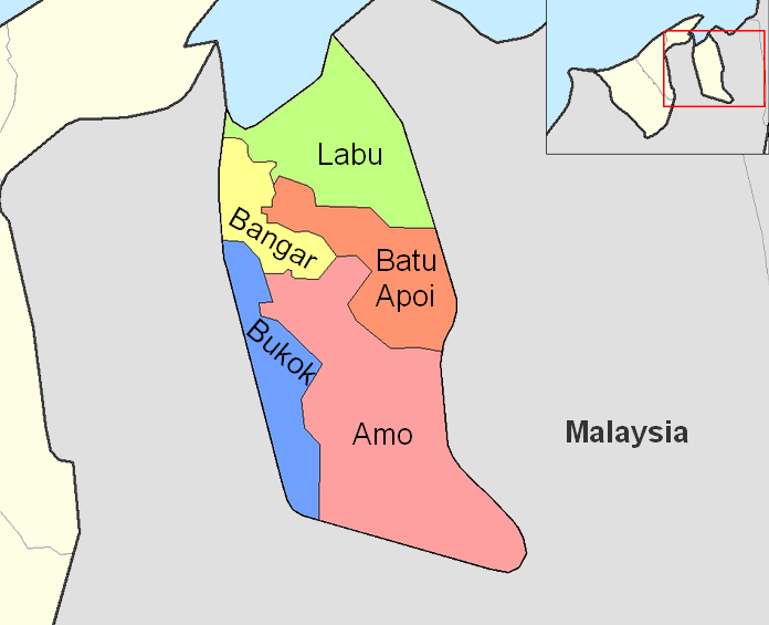
English: Map of the mukims (subdivisions) of the Temburong District of Brunei, in the northwest of the island of Borneo.
Created by Rarelibra 21:37, 11 September 2006 (UTC) for public domain use, using MapInfo Professional v8.5 and various mapping resources. |
| Sanasi | 11 Sentyabr 2006 (original upload date) |
| Manba | Transferred from en.wikipedia to Commons by Xfigpower. |
| Muallif | Rarelibra at inglizcha Vikipediya |
Litsenziyalash
| This work has been released into the public domain by its author, Rarelibra at inglizcha Vikipediya. This applies worldwide. In some countries this may not be legally possible; if so: Rarelibra grants anyone the right to use this work for any purpose, without any conditions, unless such conditions are required by law. |
Original upload log
The original description page was here. All following user names refer to en.wikipedia.
- 2006-09-11 21:37 Rarelibra 1056×816×8 (19331 bytes) Map of the mukims of Temburong district of Brunei. Created by ~~~~ for public domain use, using MapInfo Professional v8.5 and various mapping resources.
Fayl tarixi
Faylning biror paytdagi holatini koʻrish uchun tegishli sana/vaqtga bosingiz.
| Sana/Vaqt | Miniatura | Oʻlchamlari | Foydalanuvchi | Izoh | |
|---|---|---|---|---|---|
| joriy | 08:59, 27-Fevral 2011 | | 696 × 565 (57 KB) | Naturals | color + change size and type of font |
| 13:27, 3-Iyul 2008 |  | 1 056 × 816 (19 KB) | Xfigpower | {{Information |Description={{en|Map of the mukims of Temburong district of Brunei. Created by Rarelibra 21:37, 11 September 2006 (UTC) for public domain use, using MapInfo Professional v8.5 and various mapping resources.}} |Source=T |
Fayllarga ishoratlar
Bu faylga quyidagi sahifa bogʻlangan:
Faylning global foydalanilishi
Ushbu fayl quyidagi vikilarda ishlatilyapti:
- de.wikipedia.org loyihasida foydalanilishi
- en.wikipedia.org loyihasida foydalanilishi
- es.wikipedia.org loyihasida foydalanilishi
- fa.wikipedia.org loyihasida foydalanilishi
- frr.wikipedia.org loyihasida foydalanilishi
- fr.wikipedia.org loyihasida foydalanilishi
- hu.wikipedia.org loyihasida foydalanilishi
- id.wikipedia.org loyihasida foydalanilishi
- it.wikipedia.org loyihasida foydalanilishi
- ja.wikipedia.org loyihasida foydalanilishi
- ko.wikipedia.org loyihasida foydalanilishi
- lt.wikipedia.org loyihasida foydalanilishi
- nl.wikipedia.org loyihasida foydalanilishi
- no.wikipedia.org loyihasida foydalanilishi
- pl.wikipedia.org loyihasida foydalanilishi
Ushbu faylni koʻproq global foydalanishdan koʻring.