Fayl:Tokyo-to géolocalisation.svg

Size of this PNG preview of this SVG file: 800 × 488 piksel. Boshqa oʻlchamlari: 320 × 195 piksel | 640 × 390 piksel | 1 024 × 625 piksel | 1 280 × 781 piksel | 2 560 × 1 561 piksel | 1 720 × 1 049 piksel.
Asl fayl (SVG fayl, asl oʻlchamlari 1 720 × 1 049 piksel, fayl hajmi: 1,89 MB)
Qisqa izoh
| Camera location | | View this and other nearby images on: OpenStreetMap |
|---|
| Taʼrif |
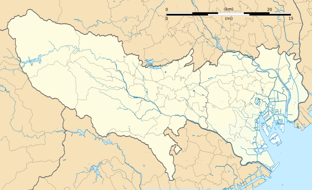
Français : Carte vierge de la préfecture métropolitaine de Tokyo (東京都, Tōkyō-to), au Japon, destinée à la géolocalisation.
Deutsch: Karte der Präfektur Tokio.
English: Blank map of the prefecture of en:Tokyo, for geolocalisation purpose.
Español: Mapa de la prefectura de Tokio.
Italiano: Mappa della metropoli di it:Tokyo.
日本語: 東京都の地図.
한국어: 도쿄도의 지도.
Português: Carta de la Metrópole de Tóquio.
|
||
| Sanasi | (UTC) | ||
| Manba |
Création personnelle ;
|
||
| Muallif | © Bourrichon (talk) - fr:Bourrichon | ||
| Ruxsat (Bu faylning takror foydalanilishi) |
|
||
| Other versions | File:Tokyo-to géolocalisation relief.svg |

|
This SVG file contains embedded text that can be translated into your language, using any capable SVG editor, text editor or the SVG Translate tool. For more information see: About translating SVG files. |
This W3C-unspecified vector image was created with Inkscape .
Litsenziyalash
I, the copyright holder of this work, hereby publish it under the following license:
This file is licensed under the Creative Commons Attribution-Share Alike 2.0 France license.
Attributsiya: Bourrichon (atelier graphique)
- Siz erkinsiz:
- ulashishga – ishlanmani nusxalash, tarqatish va uzatish
- remiks qilishga – ishni moslashtirishga
- Quyidagi shartlar asosida:
- atribut – Siz tegishli litsenziyaga havolani taqdim etishingiz va oʻzgartirishlar kiritilganligini koʻrsatishingiz kerak. Siz buni har qanday oqilona yoʻl bilan qilishingiz mumkin, lekin litsenziar Sizni yoki Sizning foydalanishingizni ma'qullashini taklif qiladigan tarzda emas.
- bir xil ulashish – Agar Siz materialni remiks qilsangiz, oʻzgartirsangiz yoki unga asoslansangiz, oʻz hissalaringizni asl nusxadagi kabi bir xil yoki mos litsenziya ostida tarqatishingiz kerak.

Fayl tarixi
Faylning biror paytdagi holatini koʻrish uchun tegishli sana/vaqtga bosingiz.
| Sana/Vaqt | Miniatura | Oʻlchamlari | Foydalanuvchi | Izoh | |
|---|---|---|---|---|---|
| joriy | 19:29, 2-Iyul 2013 | | 1 720 × 1 049 (1,89 MB) | Bourrichon | +quelques rivières |
| 18:43, 2-Iyul 2013 |  | 1 720 × 1 049 (1,06 MB) | Bourrichon | == {{int:filedesc}} == {{Location|35|70|00|N|139|00|00|E|scale:10000}} {{Information |Description= {{fr|Carte vierge de la préfecture métropolitaine de Tokyo (東京都, ''Tōkyō-to''), au Japon, destinée ... |
Fayllarga ishoratlar
Bu faylga quyidagi 2 sahifalar bogʻlangan:
Faylning global foydalanilishi
Ushbu fayl quyidagi vikilarda ishlatilyapti:
- ar.wikipedia.org loyihasida foydalanilishi
- az.wikipedia.org loyihasida foydalanilishi
- ceb.wikipedia.org loyihasida foydalanilishi
- de.wikipedia.org loyihasida foydalanilishi
- en.wikipedia.org loyihasida foydalanilishi
- Shibuya
- Harajuku
- Ōta, Tokyo
- Tokyo Station
- Ōsaki Station
- Shinagawa Station
- Tamachi Station (Tokyo)
- Hamamatsuchō Station
- Harajuku Station
- Shinjuku Station
- Yūrakuchō Station
- Gotanda Station
- Meguro Station
- Ebisu Station (Tokyo)
- Ueno Station
- Ikebukuro Station
- Shibuya Station
- Shimbashi Station
- Yoyogi Station
- Keiō-hachiōji Station
- Okachimachi Station
- Akihabara Station
- Kanda Station (Tokyo)
- Yokota Air Base
- Nakano Station (Tokyo)
- Ochanomizu Station
- Iidabashi Station
- Tokyo Metropolitan University
- Chōfu Airport
- Takadanobaba Station
- Kyōbashi Station (Tokyo)
- Kabukichō
- Sengaku-ji
- Mejiro Station
- Nishi-Nippori Station
- Nippori Station
- Shin-Ōkubo Station
- Ōtsuka Station
- Sugamo Station
- Komagome Station
- Tachikawa Station
- Futako-tamagawa Station
- Shimo-kitazawa Station
- Hachiōji Station
Ushbu faylni koʻproq global foydalanishdan koʻring.