Fayl:Turkey Western. Lesbos, Dardanelles 1.JPG
Bu prevyuning hajmi: 397 × 599 piksel. Boshqa oʻlchamlari: 159 × 240 piksel | 318 × 480 piksel | 508 × 768 piksel | 678 × 1 024 piksel | 2 008 × 3 032 piksel.
Asl fayl (2 008 × 3 032 piksel, fayl hajmi: 1,72 MB, MIME tipi: image/jpeg)
Qisqa izoh
| Taʼrif |
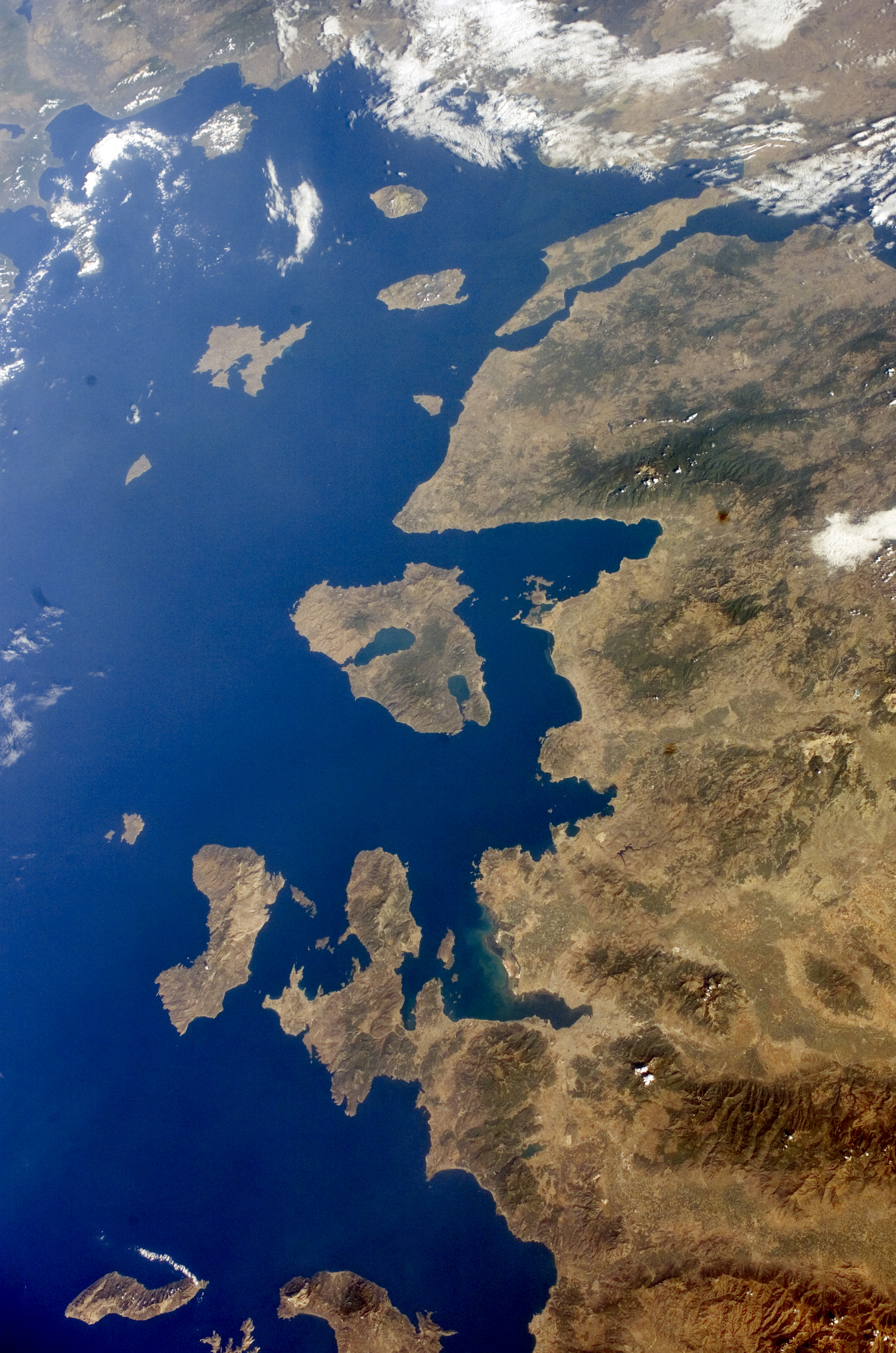
English: Turkey Western, Lesbos and Dardanelles.
Español: Noroeste de Turquía, Lesbos y Dardanelos. Mapa satelital de la Nasa (2005). |
| Sanasi | |
| Manba | http://eol.jsc.nasa.gov/scripts/sseop/QuickView.pl?directory=ESC&ID=ISS011-E-13602 |
| Muallif | NASA |
| Other versions |


.JPG)
.JPG)
Litsenziyalash
This file is in the public domain in the United States because it was created by the Image Science & Analysis Laboratory, of the NASA Johnson Space Center. NASA copyright policy states that "NASA material is not protected by copyright unless noted". (NASA media use guidelines or Conditions of Use of Astronaut Photographs).
Photo source: ISS011-E-13602.
|
Fayl tarixi
Faylning biror paytdagi holatini koʻrish uchun tegishli sana/vaqtga bosingiz.
| Sana/Vaqt | Miniatura | Oʻlchamlari | Foydalanuvchi | Izoh | |
|---|---|---|---|---|---|
| joriy | 22:52, 3-Avgust 2014 | | 2 008 × 3 032 (1,72 MB) | Ras67 | new rendered from NASA's raw image data |
| 01:31, 18-Aprel 2010 |  | 423 × 639 (99 KB) | Dorieo | {{Information |Description={{en|1=Turkey Western, Lesbos and_Dardanelles.}} {{es|1=Noroeste de Turquía, Lesbos y Dardanelos. Mapa satelital de la Nasa (2005).}} |Source=http://eol.jsc.nasa.gov/scripts/sseop/QuickView.pl?directory=ESC&ID=ISS011-E-13602 |A |
Fayllarga ishoratlar
Bu faylga bogʻlangan sahifalar yoʻq.
Faylning global foydalanilishi
Ushbu fayl quyidagi vikilarda ishlatilyapti:
- az.wikipedia.org loyihasida foydalanilishi
- ceb.wikipedia.org loyihasida foydalanilishi
- en.wikipedia.org loyihasida foydalanilishi
- es.wikipedia.org loyihasida foydalanilishi
- eu.wikipedia.org loyihasida foydalanilishi
- he.wikipedia.org loyihasida foydalanilishi
- hy.wikipedia.org loyihasida foydalanilishi
- it.wikipedia.org loyihasida foydalanilishi
- ku.wikipedia.org loyihasida foydalanilishi
- nn.wikipedia.org loyihasida foydalanilishi
- ru.wikipedia.org loyihasida foydalanilishi
- tr.wikipedia.org loyihasida foydalanilishi
- www.wikidata.org loyihasida foydalanilishi