Fayl:Kurdistan 1998.png

Bu prevyuning hajmi: 685 × 600 piksel. Boshqa oʻlchamlari: 274 × 240 piksel | 548 × 480 piksel | 966 × 846 piksel.
Asl fayl (966 × 846 piksel, fayl hajmi: 57 KB, MIME tipi: image/png)
Qisqa izoh
| Taʼrif |
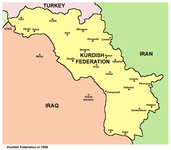
English: Map of Kurdish Federation (Southern Kurdistan) in 1998. |
| Sanasi | |
| Manba | Oʻzimning ishim |
| Muallif | PANONIAN |
Litsenziyalash
I, the copyright holder of this work, hereby publish it under the following license:
| This file is made available under the Creative Commons CC0 1.0 Universal Public Domain Dedication. | |
| The person who associated a work with this deed has dedicated the work to the public domain by waiving all of their rights to the work worldwide under copyright law, including all related and neighboring rights, to the extent allowed by law. You can copy, modify, distribute and perform the work, even for commercial purposes, all without asking permission.
|
References
Created according to these sources:
- http://www.globalsecurity.org/military/world/war/kurdistan-maps.htm
- http://www.globalsecurity.org/military/world/war/images/kurdistan-map-large.gif
- http://www.globalsecurity.org/military/world/war/images/kurdistan-map-ed.gif
- http://pshdar.com/image/sher/heremi-kurdistan.gif
- http://www.zagros.org/images/kurdistan/herem-map.jpg
Fayl tarixi
Faylning biror paytdagi holatini koʻrish uchun tegishli sana/vaqtga bosingiz.
| Sana/Vaqt | Miniatura | Oʻlchamlari | Foydalanuvchi | Izoh | |
|---|---|---|---|---|---|
| joriy | 21:07, 10-Avgust 2014 | | 966 × 846 (57 KB) | PANONIAN | more cities |
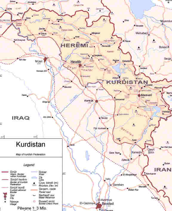
| 10:25, 14-Iyun 2012 |  | 966 × 846 (45 KB) | PANONIAN | {{Information |Description ={{en|1=Map of Kurdish Federation in 1998.}} |Source ={{own}} |Author =PANONIAN |Date =2012 |Permission = |other_versions = }} |
Fayllarga ishoratlar
Bu faylga quyidagi sahifa bogʻlangan:
Faylning global foydalanilishi
Ushbu fayl quyidagi vikilarda ishlatilyapti:
- ar.wikipedia.org loyihasida foydalanilishi
- arz.wikipedia.org loyihasida foydalanilishi
- ast.wikipedia.org loyihasida foydalanilishi
- bs.wikipedia.org loyihasida foydalanilishi
- ca.wikipedia.org loyihasida foydalanilishi
- cs.wikipedia.org loyihasida foydalanilishi
- da.wikipedia.org loyihasida foydalanilishi
- de.wikipedia.org loyihasida foydalanilishi
- el.wikipedia.org loyihasida foydalanilishi
- en.wikipedia.org loyihasida foydalanilishi
- eo.wikipedia.org loyihasida foydalanilishi
- es.wikipedia.org loyihasida foydalanilishi
- fr.wikipedia.org loyihasida foydalanilishi
- he.wikipedia.org loyihasida foydalanilishi
- hy.wikipedia.org loyihasida foydalanilishi
- it.wikipedia.org loyihasida foydalanilishi
- ja.wikipedia.org loyihasida foydalanilishi
- ko.wikipedia.org loyihasida foydalanilishi
- ku.wiktionary.org loyihasida foydalanilishi
- ms.wikipedia.org loyihasida foydalanilishi
- nl.wikipedia.org loyihasida foydalanilishi
- pl.wikipedia.org loyihasida foydalanilishi
- ru.wikipedia.org loyihasida foydalanilishi
- sh.wikipedia.org loyihasida foydalanilishi
- simple.wikipedia.org loyihasida foydalanilishi
- sr.wikipedia.org loyihasida foydalanilishi
- su.wikipedia.org loyihasida foydalanilishi
- ta.wikipedia.org loyihasida foydalanilishi
- tr.wikipedia.org loyihasida foydalanilishi
- uk.wikipedia.org loyihasida foydalanilishi