Fayl:NPS american-samoa-map.pdf

Size of this JPG preview of this PDF file: 800 × 548 piksel. Boshqa oʻlchamlari: 320 × 219 piksel | 640 × 438 piksel | 1 024 × 701 piksel | 1 250 × 856 piksel.
Asl fayl (1 250 × 856 piksel, fayl hajmi: 290 KB, MIME tipi: application/pdf)
Qisqa izoh
| Taʼrif |
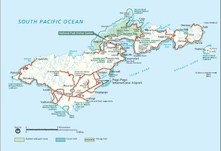
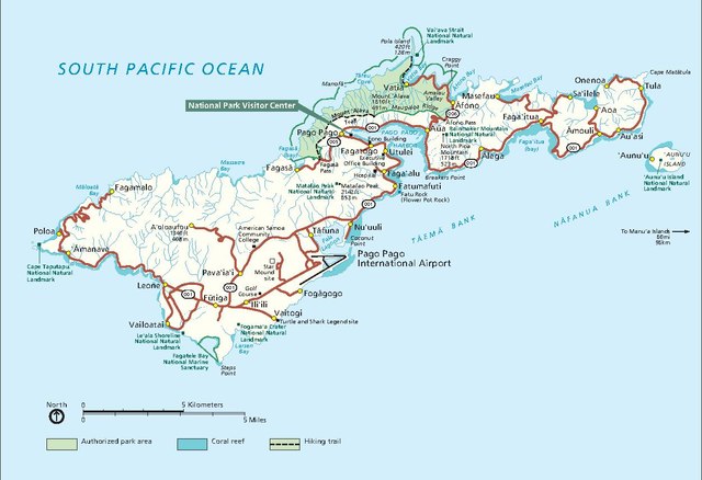
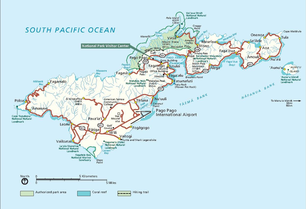
English: Main American Samoa map showing the park lands on Tutuila Island around Pago Pago. |
| Sanasi | |
| Manba | U.S. National Park Service (http://npmaps.com/wp-content/uploads/american-samoa-map.pdf) |
| Muallif | U.S. National Park Service, restoration/cleanup by Matt Holly |
| Other versions |
 |
Litsenziyalash
| This image or media file contains material based on a work of a National Park Service employee, created as part of that person's official duties. As a work of the U.S. federal government, such work is in the public domain in the United States. See the NPS website and NPS copyright policy for more information. |
Fayl tarixi
Faylning biror paytdagi holatini koʻrish uchun tegishli sana/vaqtga bosingiz.
| Sana/Vaqt | Miniatura | Oʻlchamlari | Foydalanuvchi | Izoh | |
|---|---|---|---|---|---|
| joriy | 06:33, 12-May 2017 |  | 1 250 × 856 (290 KB) | RKBot | =={{int:filedesc}}== {{Information |description= {{en|1=Main American Samoa map showing the park lands on Tutuila Island around Pago Pago.}} |date= 2016-02-22 |source= U.S. National Park Service (http://npmaps.com/wp-content/uploads/american-samoa-map.... |
Fayllarga ishoratlar
Bu faylga quyidagi sahifa bogʻlangan:
Faylning global foydalanilishi
Ushbu fayl quyidagi vikilarda ishlatilyapti:
- en.wikipedia.org loyihasida foydalanilishi
- fr.wikipedia.org loyihasida foydalanilishi
- pl.wikipedia.org loyihasida foydalanilishi
- sm.wikipedia.org loyihasida foydalanilishi
- tt.wikipedia.org loyihasida foydalanilishi